
This is Tussey Mountain as seen from afar. It sure looks smaller from this distance than it feels from up-close. Wikipedia has a much more convincing photo.

My interest in climbing Tussey Mountain was due to the fact that I'd been hearing the name for many years, and I wanted to add it to the list of "peaks" I'd documented on a certain peak-baggers' website--with photos. While I was up there, I also wanted to take a photo of Stone Mountain. I had already claimed Stone Mountain on the peak baggers' site and wanted to add a photo of the peak from afar. I'm the first person on the site to claim Stone Mountain, making me "King of the Mountain" for that low ridge of 2,190 feet--with 560 feet prominence. Apparently a mountain's "prominence" is the distance that it rises above the surrounding countryside.

See here, even the trees of Central Pennsylvania are praying for Ukraine. Honestly, I've done much higher and more taxing climbs on mountainsides in Colorado and arrived at far more stunning views. But because those climbs did not take me to any "peaks," these lesser ascents are claimable and the higher ones out west are not. You can even claim having "ascended" the high point for the state of Delaware--a mere hill of 447 feet--and that counts. However, climbing 3,000 feet to a waterfall overlooking Vail does not because it's not at the top of the mountain. Real mountain climbers must resent us Easterners claiming 2,100 foot hills as "mountains" that we've "summitted."

I was mistaken if I expected a clear view of Stone Mountain from the summit of Tussey Mountain. There's a freestanding mountain called Round Top that obscures the view. See them here: Round Top in the foreground and Stone Mountain at the horizon.

About halfway up Tussey Mountain on the Yellow Trail, you come across a place known as "Indian Overlook." It looks out across farmland to the north and west.
I thought these views were spectacular and assumed that I must be almost at the crest of the rocky mountain.

But no. The westward view from Indian Overlook is actually not that high and not that great.... After the overlook, you pass through a wooded plateau before beginning the last climb toward the actual crest. There's a slippery rock scramble toward the actual summit of Tussey Mountain--steep and slippery with rocks the size of large gravel.

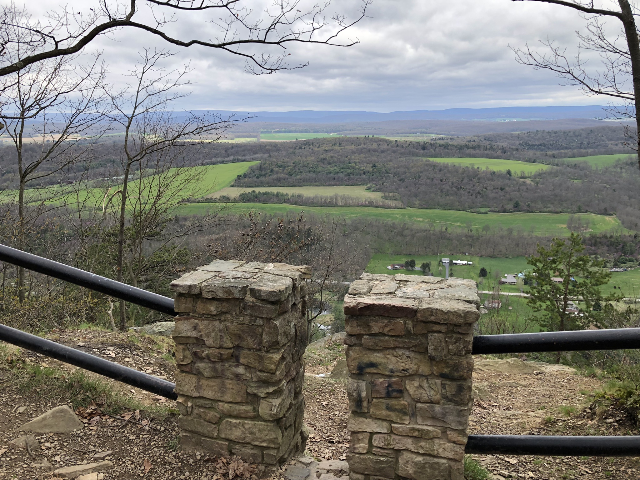
But then you reach the crest of the mountain, and here you are. If you come anytime between November and April, you'll find the branches bare, which makes the view so much better. I imagine it's a "green tunnel" in high summer, with the occasional opening among the green boughs. See in this photo how the countryside falls away to either side of the peak.

This is the Mid State Trail, where ridge-walking is a way of life...at least for a few weeks. There's little water up here on the heights, and the wind blows hard.

But the views are lovely. This is a shot from the summit of Tussey Mountain near Colerain Road, looking northwest into farmland.

This is looking east from the same trail. There are so many more mountains off this direction. The ridge in the middle distance, right on the horizon where the land meets the sky, is Stone Mountain, which a friend and I explored in a snowstorm last week, and of which (did I mention?) I'm king.

Here again is Stone Mountain--my regal domain. But how can you look away from its ephemeral beauty, its delicate charms--distant, unapproachable, veiled in blue mists, older than all knowing? These peaks were once as high as the Rockies, but they've eroded over vast eons of time. These are said to be some of the most ancient mountains on earth.

Here's a view looking the opposite direction--west and south.

This interestingly shaped feature is called Brush Mountain. It looms, doesn't it? I gotta say, I don't love the utilitarian, unimaginative names of these hills.

Instead of taking the steep and rock-strewn trail back to the bottom, I followed a forest road--just because long, rocky downhill treks are hard on an old guy's knees.

There's a camping area with two picnic tables a little more than halfway down the mountain, and approachable by car. Here's the view from there. It was a beautiful day on Tussey Mountain. I was looking forward to claiming the ascent on the peak-baggers' site, but found that although many peaks on Tussey Mountain are named and mapped, this one is not. Round Top is on there--and no one has claimed it yet, meaning that I could be "king" of that mountain, too. But even though the ridge I reached on foot was a little taller than Round Top, I hesitate to place a misleading claim. There is a path to the top of Round Top, so I could come back and claim it aright. But the three-hour drive each direction was wearisome, as was the chore of crossing Pittsburgh in evening rush hour traffic. All in all, a nice day on the chilly heights of Tussey Mountain.
No comments:
Post a Comment