Saturday, February 25, 2023

Laurel Highlands Trail, Route 31 Shelter Area

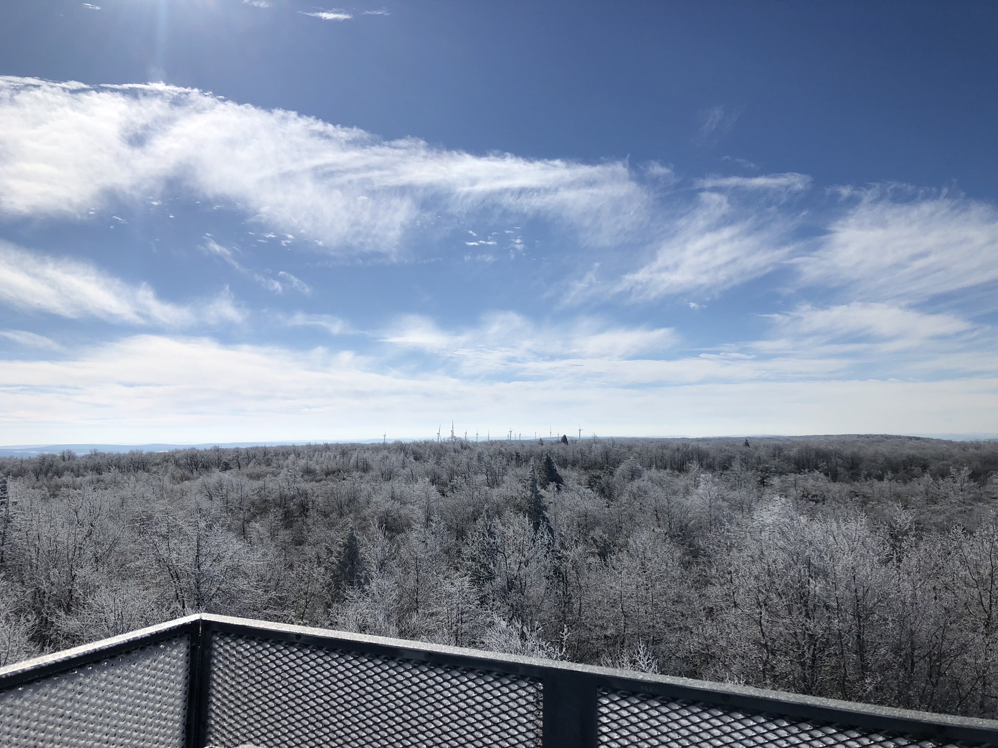
A friend and I have taken to doing winter backpacking trips along the Laurel Highlands Trail.  We get one of these Adirondack shelters, gather lots of firewood, attach small tarps in the big gaping openings on either side of the chimney, and have ourselves a merry old time in the wintry forest.  No humidity, no bugs, no other people making their noise!  (No one to complain when I play my pan flute in the chilly forest nights.)
Along the Laurel Highlands Trail, you're required to stay in one of the official camping areas, and you have to reserve your site beforehand, either for a tent or else one of these cool shelters with a fireplace.  See, it's kind of cozy inside these shelters.  Of course, it can get plenty cold, even with a fire going--hence the tarps.  In fact, the day we arrived it was an eerie 70 degrees.  Overnight the temperatures plummeted to 24 degrees.  When we woke up the next day, it was frigid.  That day did not see temps rising above 34 degrees.  On our second night, we kept the fire going all night long, which made it bearable, even though ice formed in my water bottle, which was all of 10 feet from the fire.
Oh, what I wouldn't give for a little place like this in the woods--though this cabin has a slightly creepy air about it.  
You're not technically supposed to stay two consecutive nights in these shelters along the Laurel Highlands Trail.  They're primarily for "thru-hikers" who do the whole 70-mile trail in one long trek.  (I am going to be one of them someday.)  And if it had meant depriving someone else of a place to stay, then we definitely would not have stayed two nights here.  But I looked online beforehand.  Aside from us, there was no one staying in the Route 31 camping area.  You see very few people on the trail in February.  So my friend reserved the shelter in his name on the first night, and I reserved it in my name on the second night.  The park ranger did stop by, and he knew exactly what we had done, but didn't seem to care.  
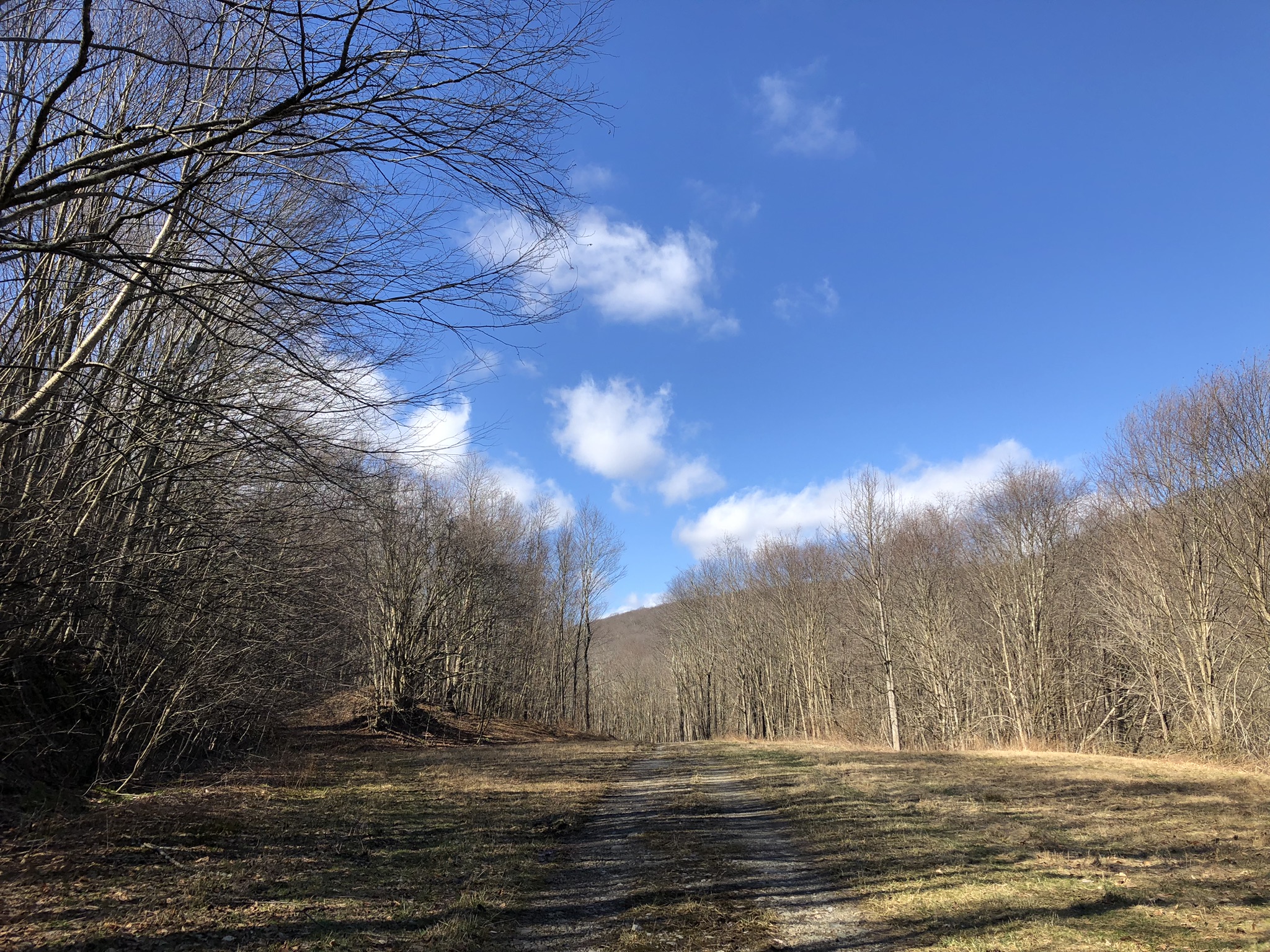
We hiked mostly around the Blue Hole Division of the Forbes State Forest.

Evitts Mountain and the Mason Dixon Line

Here's the pleasant if unspectacular view from the top of Evitts Mountain, looking southeast into Maryland.  Actually, the best way to get to this spot is by following the trail from Maryland into Pennsylvania.  Although only Maryland goes to the effort of putting in and maintaining a trail, all the views are on the Pennsylvania side of the Mason Dixon--which you cross in the forest at the summit.
This shot looks northwest into Pennsylvania.  There's a sad homemade monument to someone called "Jenny Girl" in this photo.  I wonder what her story is.  Every place has many stories; it was the story of Evitts Mountain that brought me here.  At Maryland's Rocky Gap State Park, you can follow the Evitt's Homesite Trail up to the summit.  About halfway up the mountain are the remains of an old homestead from the early 1700s.  It's said to have been the home of a hermit who moved out to the furthest frontier to be alone when he found that no woman would have him--especially not the one he loved.  All there really is to see is an old well.
The hermit's name was Evart, and the mountain is named after him, with a slight variation in spelling.  Here's the old historic Mason Dixon Line marker in the woods beside the trail.  The "M" is for Maryland.  It's hard to believe that Maryland was ever considered part of "The South."  Today it's a proud little suburban state that touts its several modest attractions and manages to be a lot more progressive than its neighbor to the north.  In a way, Maryland has it all: beaches, forests, mountains, at least one big city.  But in another way, all the stuff it has is on the slightly mediocre side.  Gritty Baltimore is its one big city; these hills are its idea of mountains, but I've heard its coastline is nice... 
It's the Belgium of the states, an in-between place where cultures have come to clash, where wars have been fought, where silent battlefields bear witness to a violent past with monuments and solemn, hushed lawns where many died.  Historic sites, sprawling, wealthy suburbs, screaming interstates, a few carefully preserved patches of woods, rail trails, a small but busy beach.  That's Maryland.  I like it.  
Along the Evitt's Homesite Trail, the Mason Dixon Line marker is a little less impressive.  To get the views, you have to keep hiking a short distance into Pennsylvania, where the trail cuts rightward and down the mountainside.  How many an enslaved person made for this arbitrary political line, this artificial and invisible boundary, only to discover that their so-called "owners" were allowed to pursue them even once they got past this line?
The marker does have rather a grand air about it, sitting as it does at the summit of the mountain and overlooking two states.  In the summer, there would be little to see here.  Just leaves.
Looking again from Pennsylvania into Pennsylvania.
And again.
You see this signpost along the trail in the Maryland state park?  This is how a state with a modicum of pride goes about the art of existing.  They've got their classy, historic state logo at the top, but adapted, with an oakleaf to make it more outdoorsy.  They've got the trails all nicely marked and color-coded like the maps.  This is Maryland: modest, fussy, orderly, proud.  They've got good signage and an identity that they try to make visible.  Driving along the interstate, they advertise "scenic overlooks," which rarely amount to much, but at least they're trying.  

Wednesday, February 1, 2023

Mt. Davis, Pennsylvania’s High Point in Winter


At 3,213 feet above sea level, Pennsylvania’s highest point is a mere 4 feet higher than England’s Scafell Pike.  It’s nice to be a little taller than someone else—speaking as a guy who stands on the short side of average.  However, England’s tallest hill definitely cuts a finer figure than Pennsylvania’s.  This was a pleasant 2-mile out-and-back hike in the snow at 17 degrees!  Here’s the westward view from the top.


Our state’s high point is in the Forbes State Forest, and it’s probably visited mainly by those collectors who tour the high point of every state in the country.  On one hand, you’ve got a mere rise of some 450 feet in Delaware—which is maybe a little taller than Florida.  (It’s generous of me to mention Delaware because I do not recognize its statehood; it used to be Pennsylvania’s coastline, and it consists of a mere three counties, two in high tide.)  But can you even reach Alaska’s Denali peak without doing a technical climb with snowshoes and ice picks and mountaineer training?  Mt. Davis’s summit is covered in trees.  Without the lookout tower, there would be no views at all.  This is the eastward vista.


And this is looking south.  I actually didn’t “ascend” Mt. Davis except in a car.  My little Kia couldn’t navigate the treacherous, snowy back roads that lead to the base of the mountain, where there is a long trail to the top.  Instead, I drove to the picnic area, located one mile away from the lookout tower, and I hiked from there.  With the winter sun so bright, it hardly felt cold at all.


This view looks north, where the upland rolls on for many miles.  That’s really all Mt. Davis is: an upland hidden among Amish farmlands and ramshackle old villages with ornate little churches, immense pre-Civil War houses, and weathered political signs still in the yards supporting the villainous Doug Mastriano—the failed Republican candidate for governor who denies climate change and intended to outlaw all abortions whatsoever for any reason.  (We really dodged a bullet, and not by as wide a margin as I’d like.)


There was not another soul to be seen anywhere in the woods today, although there were a few sets of footprints in the snow.  Those footprints did not go to the top of the lookout tower.  It was cold and gusty up top with ice and snow encrusted on the frigid steel.


Ice formed in the grates to create a temporary thing of beauty—which I suppose all things of beauty are: temporary.  It’s some comfort that all hideous things are, too.


Ice also collected in the bare branches of the treetops at the summit of the mountain.  It was good to have my crampons and gloves this time around.  The footing was a bit treacherous in places, frozen and slick.


This is my second and—frankly—probably my last visit to Mt. Davis.  I came here with a group of guys many years ago in the summertime.  It’s just not beautiful enough or interesting enough for another return trip.  The countryside around here is scenic, with lots of forests and contour-plowed Amish farms.  Nearby Meyersdale has a maple syrup festival in March, which is interesting.  But the world is big and time is short!  On to other things!