Wednesday, October 6, 2021

Laurel Highlands Trail at Kings Mountain Road


It wasn't easy to find the Laurel Highlands Hiking Trail at the high place where Kings Mountain Road peters out into a muddy ATV track.  But the search was scenic and fun.  Oh, the beautiful summer homes up here near the ridge of Laurel Hill!  I just want one so bad...


I got sidetracked by a pleasant snowmobile trail that was nice enough, but not a hiking trail.  A snowmobile trail is built for vehicles, and so it's a small road, not a footpath.  It doesn't seem to penetrate the strange, shady depths of the forest in the same way.  


The road up the mountain was narrow and lovely in the October light.  I did at last find the LHHT but following it further than I'd have expected.  See the stone steps in the lower right corner of this photo.  That's the LHHT.


The golden ferns, the yellowing and browning beech leaves, the golding, and redding, and oranging trees across wide meadows, the glowering and grayling skies.  It was a beautiful day to be alone in the woods at the top of Laurel Ridge.


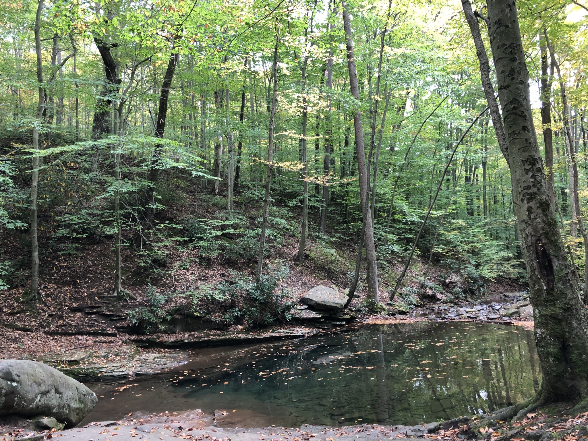
Again, the map showed a scenic overlook--or at least something photographable--just a short distance from Kings Mountain Road, between mile markers 21 and 22.  And so, I went a-looking for it.  I wish my cell camera, or any camera, could capture the great beauty of this spot in the forest, which is no overlook but truly memorable.  See the strangely majestic beech tree a little to the left and the broad rock floor?  


Here's that same majestic beech from another angle, still insufficient to capture its power and stateliness.  


It looks almost African.


Sometimes I wonder if I shouldn't invest in a decent camera.  If I did, I'd be able to capture the grandeur and perfection of this ancient beech.  I'd also be able to publish a coffee table book about country churches in Western Pennsylvania.


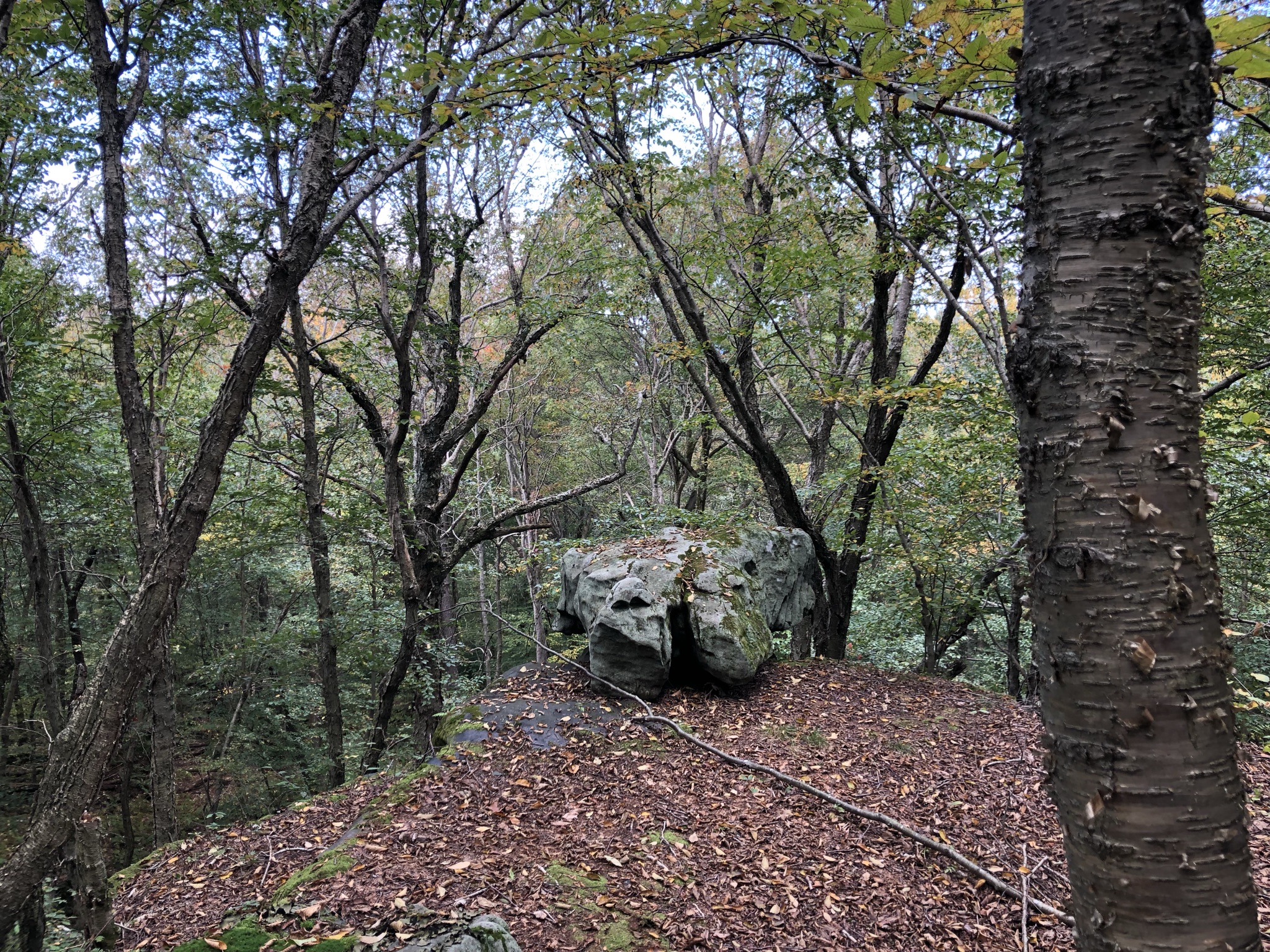
So, just beneath that wondrous tree, there's a rock ledge that overlooks the forest floor below.  See here.  It's got a nice boulder sitting out at the edge to tempt photos and picnics.  I fell into both traps.


It's not an enormous drop to the forest floor below, 20 feet?  But when the leaves are off, there might be a nice view to the hills beyond.


Blue Hole and Cole Run Falls, Forbes State Forest


I'd always heard about "Blue Hole" and thought it sounded like a kind of magical place.  Long ago I even tried to get there once and failed.  But one of the reasons I love maps is because I happened to notice on my old-fashioned paper map that my trek on the Laurel Highlands Hiking Trail near Kings Mountain Road was very close to the mysterious Blue Hole area of the Forbes State Forest.


It's a beautiful drive out to Blue Hole, a long, long descent into down from the summit of Laurel Ridge to the forest valleys on the flanks of that long hill.  Blue Hole itself is a nicely maintained area with an information kiosk, mowed grass, and a few places to park.  And this!  This is Blue Hole.  I think people must swim here when the water levels are higher.


And strangely, the water is in fact BLUE!  Look at it.  Turquoise?  Azure?  Why is it so blue with no sky to reflect?


The roads in this part of the Forbes are so lovely and serene.  From Blue Hole I decided to go looking for the nearby Cole Run Falls.


Again, the water levels aren't very high right now, so this waterfall might be more impressive in May than October.  But the well-marked waterfall is just off the road, and it's impressive enough.  It tumbles maybe 15 feet from above.


Actually, it's a series of small waterfalls, but I really only explored the area closest to the road.  


It's not the waterfalls of Maui, but it was a sweet spot in the woods.


1970?  These trees and I are the same venerable age. 

Scenes from the Laurel Highlands in Fall


Laurel Highlands Trail at Maple Summit Road


I got to do a rare Saturday trek last weekend.  Saturdays often become work days for me, and when I don't spend them working, I spend them doing chores around the house.  But my stress load has been heavy in recent weeks, and so I decided that I owed it to everyone in my life, including myself, to get out into the sweetly-scented October woods.


I've been doing small section hikes of the Laurel Highlands Hiking Trail.  I've done a few overnight backpacking trips on that trail, but it's a little too popular for my tastes.  And yet, the discovery of a nice wooded lot for sale--only 1.5 hours from home--has got me returning to that part of the state to see what else I can find.  The lot is beautiful, affordable, and exactly what I'm looking for, though the real estate agent said the owner has decided not to sell. 


The map shows a scenic overlook along the LHHT relatively close to mile marker 9, near Maple Summit Road--so I made for that.  I didn't see anything but a lot of curious rock cities.  The biggest boulder, shown here is about 25 feet high... Interesting but hardly a scenic overlook.


It wasn't until I passed that tall boulder for the second time, on my way back toward the car, that I noticed a lightly-worn path leading up into a deep, narrow crack between the rocks.  Someone climbs these rocks--could it be for the view from the top?


It's a scramble, and the stony walls do rise 25 or 30 feet on either side of the narrow canyon.  A more confident person than I might try to scale them.  


You can't really see it in this photo, but someone has run a rope from the high branch in this tree, and they use it to climb up and down the rock face to the left.  I thought it looked a little too risky to try without a companion.


I was sure the "overlook" shown on the map was on top of those rocks, but unable to find a way up, I returned to the LHHT...where it occurred to me that I might be able to reach the top simply by bushwhacking up the gentle slope that's visible from the trail.  It worked!  I made it to the top of the boulders without risking life and limb--though I did get a tick, and the bite is red and itchy these four days later.


See this rocky ledge?  This looks straight down into the narrow canyon, 25 feet below, where I'd passed only a few minutes earlier.  It's a pleasant stony ledge in the sun, on the same level as the nearby treetops.  It reminds me for all the world of a certain antique diorama in a dark back passage of the Carnegie Museum of Natural History in Pittsburgh.  In the diorama, an eagle, or some other grand bird, is on a rocky ledge in the Laurel Highlands, looking out over barren trees.


Look to the dead center of this photo.  This is the closest thing I got to a sweeping vista, for all my efforts.  I'm sure that when the leaves are off the trees there's a better view.  But it was beautiful up there atop the boulders.

Monday, October 4, 2021

Ohiopyle in the Gathering Autumn Haze


What, the Baughman's Rock Overlook again?  Well, it was better this time.  This time around, I started out down at the Youghiogheny River on the edge of the borough of Ohiopyle--right where the Great Allegheny Passage Rail Trail leaves the town--and hiked the Lower Baughman Trail up to the summit.  (Check out all the "gh" combinations in that last sentence..."Youghiogheny" alone has two...)


It is a beautiful hike up along the steep valley wall above the rapidly moving river.


And of course, the river itself is so lovely in the golden autumn sun.


I sat on the banks and had a picnic lunch and listened to the water and the birds.


I think I'd like to tackle this on a kayak; this particular section isn't rough at all.


I had to come back down here to the Laurel Highlands.  They're only an hour and a half away and so much better than I'd remembered.  This area is essentially the Catskills of Pittsburgh.


Once atop the summit, you can make a nice loop back to your car by following the Lower Sugarloaf Trail down the other side of the mountain and back into town--less than 3 hours for the whole trek.


It was good to be in the silence of the woods, discovering new places, feeling the cool autumn air against my face.  It's not just good for the body; it's good for the soul.


The town of Ohiopyle is a curious place.  It's trying very hard to be an outdoorsy stopover on the Great Allegheny Passage, a rail trail which runs from Pittsburgh to D.C.  So, it's got bicycle rentals, and kayak rentals, and rafting outfitters, and coffee houses, and ice cream parlors, and cheap bars.  But it can't hide its grittiness.  It's still Western Pennsylvania, which means it's got a slightly haunted feel, with rundown mansions and shabby storefronts and derelict-looking old railroad paraphernalia.  


The types and sizes of bars is truly amazing for such a small place.


The church is cute, but doesn't seem to get much use.  I like the little open-air sweet shop that it seems to be sheltering beneath its wing.


Of course, the great trail runs right through the middle of it on an old railroad trestle.


And a view of the main street from the trestle. See all the tables with umbrellas?  The town is full of them.  There are probably more umbrellas than year-round residents.


This little open air bar appealed to me, though I do not and cannot drink.  It reminds me of the verandah bars that I used to frequent in tropical places.  The vines engulfing a deeply shaded deck, a little off the street and hidden away, a little bit above everything else, so a drunken American, far from home, can look down from above, unobserved.  These tropical bars were for locals mostly; only few expats frequented them.  But I could spend hours and hours in them.  I loved their shady remove, their colonial feel, their place high up among the leaves.