Sunday, October 30, 2016

"The Pennsylvanian" Amtrak Train

 One beautiful thing about living in Pittsburgh is that you can board a train here at 7:30am and arrive in New York City's Penn Station before 5:00pm.  There's no changing trains and no long stops in between, nothing but the Appalachian Mountains, and Amish Country, and all the gritty, fascinating old towns between here and there.  Yes, it's a nine-hour train ride...but the view from the windows is spectacular, especially if you go in October.
 Pictured here is the famous Horseshoe Curve near Altoona, a marvel of mid-eighteenth century engineering that is loved by railroad buffs all the world over.  I'm not exactly a railroad buff, but I sure did enjoy the long ride into Manhattan.  Passing through these low mountains in their fading autumn glory, the train would blow its mournful whistle every now and again, and the scene could not have been more perfect.
We did a really quick family trip into New York to take the kids to a Broadway show: two days aboard the train and one whole day in the City.  There were stops in Greensburg, Latrobe, Johnstown, Altoona, Huntingdon, Harrisburg, Elizabethtown, Lancaster, Paoli, Philadelphia, Trenton, and Newark.  I failed to film the most beautiful stretches of the ride, like where the train runs along the Susquehanna River near Duncanon or through the quaint farmlands of Lancaster County, with their huge stone barns adorned with carefully painted hexes.  I'm not a great fan of Broadway, and New York is an old familiar enemy, but the train ride was so worth the hassle.   
Of course, no town looks good from the tracks.  Railroads run through the seediest parts of any community, rural or urban.  Or maybe it's just that railroads are industrial and move mainly through industrial or post-industrial zones.  There's always so much decay and debris visible from a train.  Still, it was a joy to see Philadelphia through the streaked windows of the Amtrak train.  Looks like Philly's got yet another new skyscraper going up, too.

Thursday, October 20, 2016

An Indian Summer Trek

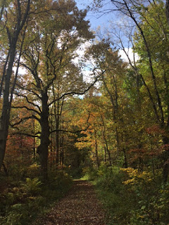
It was my idea of heaven: seven straight hours in the October woods with nothing but a stick, a bottle of water, and the collected poems of A.E. Housman.  Take a look at the tree in this photograph, so imposing, such a powerful presence looming over Nichol Road at Raccoon Creek.  I went more than a mile out of my way just to see this grand old tree in its autumn glory.  
 It was a hot Indian summer day in Pennsylvania, nothing less than glorious, with blue skies and fall colors at their peak of brightness.  I'd hoped to make it down the the Laurel Highlands, but for a variety of reasons ended up staying closer to home.  And yet, I was not disappointed.
 Funny how quickly it all becomes commonplace, the lovely colors, the cooler air, the rich smells of the decaying leaves on the forest floor.  You begin to hurry past all of it, then it's gone.  Like all things, the glorious day lives out its little span of beauty and boredom.  It grows old.  Its charms wear off.  Then it passes.
 Or at least it usually does.  Ah, but the wonder of it all never grew old to me yesterday.  I truly believe that I savored nearly every last second of the long woodland day.  I went hiking into the Pioneer backcountry campground from the parking lot an hour away.  I was testing out the trek, thinking I might want to do it as an overnight with a few friends in November.  Very doable.
 Even an overly-familiar place gives itself to you anew when you visit in a different season.  Old well-known trails seemed completely fresh in the hues of October.
 Why can't we store these times away in amber like insects?  Isn't that exactly what I'm trying to do by keeping a blog that nobody reads but me?  I'm trying to preserve all my travels so that I can flip back through them on those grim occasions when life traps me beneath fluorescent lights.  Just look at this sugar maple!
 Over the summer, on the porch of that big old wooden hotel at Chautauqua, I read an outstanding book about the afterlife.  I know what you're thinking.  But it wasn't some pious, superstitious feel-good drivel like "Heaven Is for Real."  It was an academic work written by a skeptical New Testament scholar who specializes in studies of the historical Jesus.  (He believes that Jesus was a failed millenarian prophet who expected to usher in the end of time.)  
 The book looks at a wide array of beliefs about the afterlife found in many different cultures, both ancient and modern.  One thing he discovered is that the saying, "My life flashed before my eyes" is based in an actual phenomenon that is well-documented in the moments of death.  The meaningful events of people's lives really do come flooding back to them like an intimate movie just as the brain is closing up shop.  When people have near-death experiences, there really is a moment of utter release when all the significant moments and encounters of our lives recur to us almost simultaneously, but with a reliving of all the emotions and almost total understanding of feelings that, at the time, may have confounded us.
Call it the final judgment.  It's as if we get a life review just at the end, a closing argument, a bird's eye view in perfect perspective.  This phenomenon has been attested in many different times and places.
Of course, it's too bad we can't have perfect perspective on our lives before we die.  But days like this one in the autumn woods help me to gain some semblance of it.
I'm beginning to believe that all "country" is Trump Country.  All cities are Clinton territory.  The suburbs are a mix.  But it is alarming to get just outside town and see all the widespread support for this self-serving demagogue, Donald Trump.  He's the brick that rural America is throwing through the window of the economic establishment--the very one that has impoverished them.  I get that.  It's just so unsettling to see so many hundreds of Trump signs out there amid the October splendor.  "Every prospect pleases, and man alone is vile," as the old hymn says.

Sunday, October 16, 2016

Laurel Highlands Hiking Trail, Northern Terminus

The northern end of the Laurel Highlands Hiking Trail offers some good views out over the valley of the Conemaugh River.  Unfortunately, it's a noisy valley, and so the first three miles of the trek are accompanied by an urban soundtrack of screaming automobiles, and trains, and construction vehicles, and heavy duty trucks going in reverse.  Of course, the LHHT stretches 70 miles along a ridge from Ohiopyle to this place, near Johnstown.  In fact, if you click on this photo you'll see Johnstown in the distance.  A friend and I did the long, uphill climb from the northern trailhead parking lot all the way to the first campground on the trail--just under six miles.  The hike took about three hours and a half. It was a scenic fall hike, with most of the leaves still green, and a beautiful night to sleep in the forest, where a barred owl serenaded us from very nearby until about midnight.

Saturday, October 8, 2016

Fort Necessity National Battlefield

Instead of saying that Fort Necessity National Battlefield is a yawn, let me say that it's one of only a handful of national parks or monuments in the state...and way more interesting than the Johnstown Flood National Memorial--which also belongs to the National Park Service.  There's a much-neglected picnic area way off in the woods at this park; my kids and I had it entirely to ourselves.  In the mists of the day and the seemingly total abandon, the picnic area was a little creepy.  Here is a careful replica of the fort that the French burned down upon defeating George Washington at the Battle of Great Meadows in the summer of 1754.  This part of the park is plenty crowded.
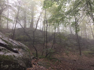
The French were retaliating for Washington's murder of a young French officer and ten or more soldiers at a "gloomy glen" on the craggy summit of Chestnut Ridge.  Actually, it seems that Washington blamed the Seneca chief "Half King" for the murder, but to this day, the events at "Jumonville Glen" lay shrouded in mystery...which is only fair, for Jumonville Glen itself was shrouded in fog on the afternoon of our visit, bottom photo.
Click on this photo to enlarge it, as with any photo on this blog.  Here is a tiny remnant of the road that General Edward Braddock hacked through virgin forest in his failed venture in 1755 to liberate "The Forks of the Ohio," from the French.  "The Forks" are now known as Point State Park in downtown Pittsburgh.  Is it strange to think that George Washington worked on behalf of the British Crown when he started the "Seven Years War," perhaps earth's first true "World War"?
Of course, here in America, we ignore the fact that the Seven Years War was a worldwide conflict.  Here, we just call it "The French and Indian War."  This is a better shot of the true Braddock's Road from Virginia to the Monongahela--which was largely developed into U.S. Highway 40, or "The National Road," in the 1800s.
It's certainly not as early as the Battle of Great Meadows, but the old inn on the grounds of the "national monument" is worth a visit.  It received many a pioneer on the westward trek into the Ohio Country in the early 1800s.  To my understanding, a "national monument" is the same thing as a national park, except smaller.
Click on this photo.  Here again is that replica of the doomed old fort that a 20-something Washington threw together in haste when he realized that the French would come to avenge the cowardly murder of an officer and some of his men in a time of peace.  It's called "Great Meadows" because the fort was erected in a large natural clearing, while everything around it was forest.  In fact the French easily captured the fort because they were able to hide in the nearby woods and launch their attack from all sides.
From Fort Necessity, with its visitors' center and tour buses, it's a seven-mile drive to the remote spot on the summit of Chestnut Ridge where the actual murders took place.  This, too, is part of the national monument.  In contrast to the areas around the fort, which were crowded and developed, the area called "Jumonville Glen" is lonely and far-flung.  We spent about 45 minutes there on an October Saturday, and in that time we had the whole place entirely to ourselves.  Click on this photo to read the plaque's inscription.  The events that transpired here are sometimes called "The Battle of Jumonville Glen," but a battle it was not.  Whereas the French were careful to maintain a respect for human life and a desire for peaceful resolution at the later Battle of Great Meadows, what happened at Jumonville Glen was an ambush a slaughter.
This is Jumonville Glen as seen from the spot of the French encampment, so named for the commanding officer of the French soldiers, Joseph Coulon de Jumonville, who was murdered here.  Washington and his men appeared atop the rocks that you see and started shooting into the band of soldiers as they wakened at 7am.  One fellow named Monceau was taking a piss and happened to escape.  He ran to the Monogahela River and paddled all the way back to the French fort at Pittsburgh to inform them of the British ambush.  Washington claimed that he tried to parlay with Jumonville and that his allied Seneca chief, named "Half King," walked up to Jumonville and opened his head with a tomahawk.  No one knows what's true, but Washington and his men left their French victims' bodies to the wolves and buzzards.  He was young, it's true, but the events at Jumonville Glen do cast a few shadows over the character of George Washington.  

Wednesday, October 5, 2016

Lesser-Known Hikes at Ohiopyle

 This is the view from Baughman Rocks at Ohiopyle State Park.  On a foggy morning like this one, there's little to see.
 But it's a scenic spot near the road with a parking lot.  It's worth a gander, but there are more secluded places at Ohiopyle, too.  And some of them are more scenic than this.
If you head all the way out to the northwesternmost corner of the park, you come to "The Old Mitchell Place."  Great name, huh?  It actually used to be a farm, and the remains of the fields and orchards are pretty clear to see, partially overtaken by forest.  On your drive out there, you'll come upon this oddity: a cemetery, and not a very old one.  The Mitchell Trail, though not extraordinarily scenic, is lesser known and a better place than many at Ohiopyle to find a little solitude.  It's a three mile loop that took me an hour to do.
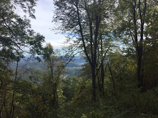
But this!  This is what I'm more proud of!  This scenic view--equal to or better than the one at Baughman Rocks--doesn't appear on any map.  As you take Sugarloaf Road south away from Baughman Rocks, you'll come across a narrow, gated dirt road running down the mountainside to the left.  The map simply calls it "Gas Well Road."  There's room for one car to park beside the gate.  It's a beautiful walk down the side of the mountain, and in some places where there are fewer trees, you get views like this.  Silence and solitude and beauty.  That's what I love.  It didn't look like the road had been used by hiker or gasman in a long, long time.