Saturday, October 22, 2022

Wolf Rocks and the Laurel Highlands Hiking Trail


Tell me not here, it needs not saying, what tune the enchantress plays

In aftermaths of soft September or under blanching mays,*

For she and I were long acquainted

And I knew all her ways.

On russet floors by waters idle, the pine lets fall its cone,

The cuckoo shouts all day at nothing in leafy dells alone;

And traveler's joy beguiles in autumn 

Hearts that have lost their own.

On acres of the seeded grasses the changing burnish heaves;

Or marshalled under moons of harvest

Stand still all night the sheaves;

Or beeches strip in storms for winter and stain the wind with leaves.

Possess, as I possessed a season, the countries I resign,

Where over elmy plains the highway would mount the hills and shine,

And full of shade the pillared forest

Would murmur and be mine.

~A.E. Housman

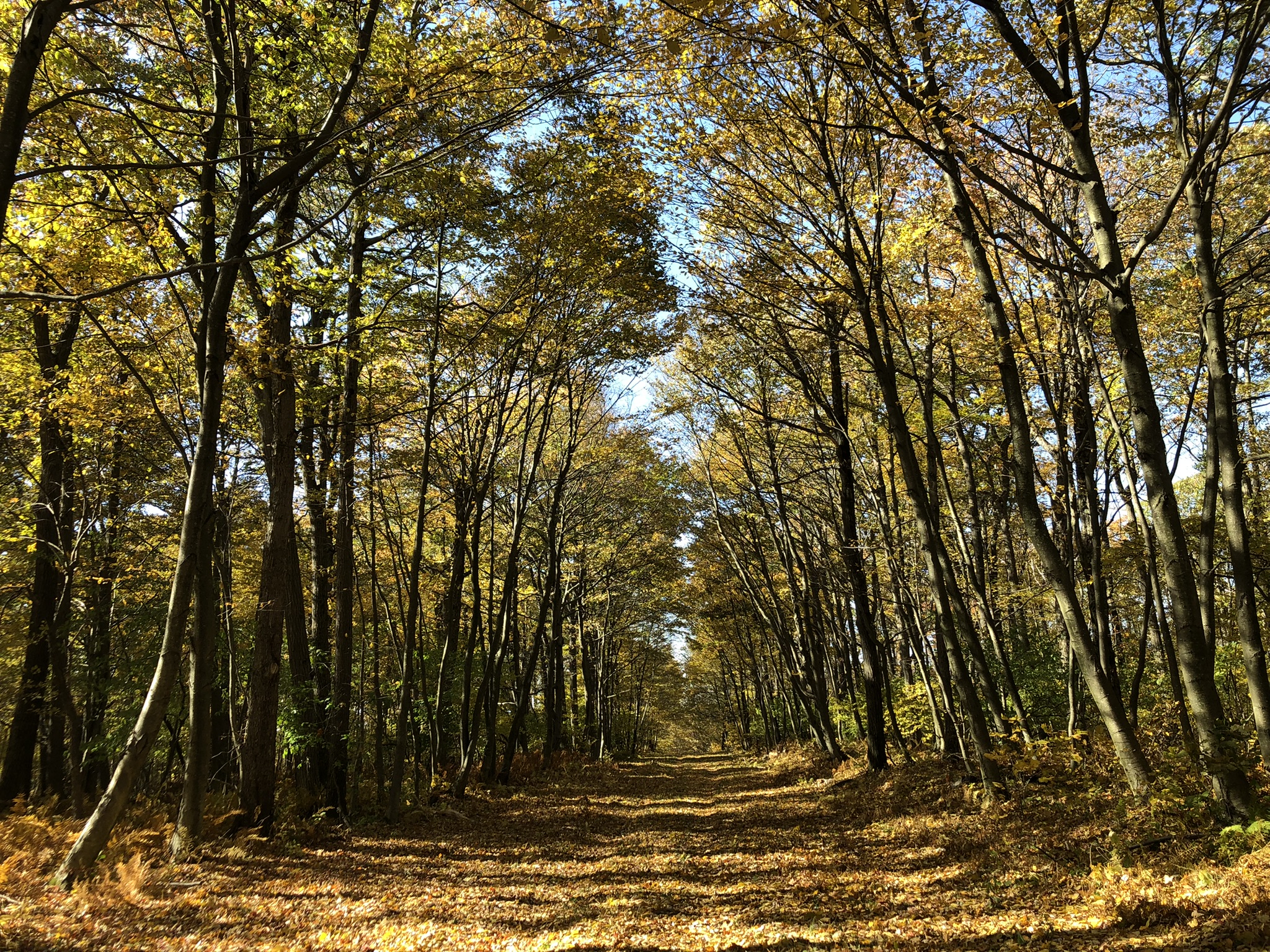
Each October I go to the woods and try to memorize poetry.  The final verse** of that autumnal poem does not deserve to be published, and so I've left it out.  
A friend and I stayed at the route 30 shelter area on the Laurel Highlands Hiking Trail.  Actually, I'm thinking this might be the place to do a thru-hike.  It's 70 miles.  The 8 shelter / camping areas are 8 to 10 miles apart.  (You're not allowed to camp outside the designated areas on this trail, and you have to reserve your spot beforehand.)  
It's relatively easy ridgetop hiking--once you get up the initial climbs at the north or south ends of the trail.  There are some nice vistas--though only a few.  And as popular as the trail is, you rarely meet many others in the camping areas.  Anyhow, it'll take a little planning and about a week of vacation time, but this is my next great woodland goal.  

*hawthorns

**Okay, okay, I feel bad bastardizing a work of art, so here's the final verse, as much as I hate it:

For nature, heartless, witless nature, will neither care nor know

What stranger's feet may find the meadow and trespass there and go,

Nor ask amid the dews of morning

If they are mine or no.

Monday, October 17, 2022

Western Pennsylvania Churches

Look closely for the church in this photo.  It’s actually the best one of the three pictured here.
I love sacred architecture—no matter the religion—and I’ve long wanted to publish a coffee table book of rural churches.  But that’s probably not going to happen because I’d have to learn how to use a real camera, and I don’t have the patience for that.  So I occasionally just put cell phone shots on here.
This one is on the steep hillside of Sugarloaf Knob, and it has a small cemetery across the road.

Pittsburgh Scenes

This video and the pictures below were all taken on the Saturday of Indigenous Peoples’ Day, so the autumn colors are far less advanced than they are today. After working all week, I had to work the weekend as well and didn’t have time to get to the woods after work let out on Saturday evening.  Actually, I work every Saturday in October and of course each Sunday, which is the absolute worst, since it’s my favorite month of the year and the best October we’ve had in a long time.  These photos are all taken from the Mt. Washington neighborhood. It was the closest to the woods I could get on that day before nightfall.
They’re apparently working on the rail line for the incline, which carries commuters up and down the hillside.
This otherwise relatively humble-looking apartment building overlooks downtown from above.  Those balconies must have fantastic views.  I wonder what a place in this building costs.
Looking upriver on the Monongahela…


Bald Knob and Beam Rocks, Forbes State Forest

This is the modest view from Beam Rocks on a brilliant Saturday in October.  I have never in my life seen so many cars parked along the forest road that runs along the ridge between Linn Run State Park and the Laurel Hill ski lodge. 
But it was a perfect fall day, and the colors were lovely.
I actually took my older daughter to go hiking down there because there was another peak I wanted to bag, the little-known Bald Knob, which is the highest piece of ground just above the valley of Linn Run.  At 2,930 feet, it’s a behemoth for these parts… And of course it was unclaimed on my peak-bagging site.  It’s mine now, for whatever that’s worth.
There are four transmission towers right on the peak, and no views through the trees.  I’m sure it’s a hive of unhealthy electromagnetic energy.  


Sugarloaf Knob & Baughman Rock Overlook, Ohiopyle State Park


This is the view from Baughman Rock in Ohiopyle State Park.  When this photo was taken, five days ago, the trees were maybe still about one week too early to show their best colors.  But they were still pretty.
My new thing is looking down on the world from high places—or at least high-ish places.  There are no real views through the leaves at the summit of Sugarloaf Knob, but this is lower on the flanks of the same mountain.

The goldenrod, the fading greens, the emerging radiance.  It was a beautiful time to be in the Laurel Highlands.  It wasn’t my intention to go to Ohiopyle, but the peak I’d intended to summit—a hill known as Fulton Knob—was on private land and prohibitively difficult to access.
Fulton Knob is up on Chestnut Ridge—which a lot of ignorant people call “Mt. Summit” because the hotel at the top (which is strangely similar to the one on The Shining) is called the Summit Hotel.  The way I’d planned to get to Fulton Knob turned out to be impossible for my little car.  I intended to take a certain Washington Springs Road to an electric line swath and go up the mountain on the swath.  But Washington Springs Road quickly turned into a Jeep track.  And there were No Trespassing signs all over the place.  To bad.  I think there’s a collapsed lookout tower at the top.
And so I headed for Sugarloaf Knob, which is another true summit of the uplands here.  It’s I think Ohiopyle State Park and only accessible via the Kim Trail, which is primarily for mountain bikes.
Here’s the Sugarloaf Knob from afar—but this is only just the “knob” of a much bigger hill than what you see here.

Woodcock Hill, State Game Land 265

Don’t even bother entering “State Game Land 265” into the map-app on your phone. Phones don’t know yet that this pleasant little 500-some acre patch of woods exists.  I only know about it because it appeared on the peak-bagging website that I keep talking about.  This is the true summit of a 2,530 foot height, and I gotta admit…it’s a little anticlimactic—like many of the peaks around here.
A small lane runs about one mile from the parking area on US-40 to the summit of Woodcock Hill, which is pictured in the top photo.  
A round trip is an easy 2-mile out-and-back.  Once again, I’ve added another unremarkable peak to my peak-bagging site.  I’m thinking maybe I need to go back to my old way of hiking…you know, where I pick a destination regardless of whether it’s listed as an unclaimed peak on that site…
Of course, US-40 is also known as the National Pike.  It used to go all the way from Atlantic City to San Francisco.  Now it only goes as far west as Salt Lake City, Utah.  But the Pennsylvania segment runs overtop the old original road that General Braddock hacked into the wilderness in his failed attempt to take Fort Duquesne (Pittsburgh) from the French in the 1750s.  There are a lot of historic sites, old taverns, and outdoorsy destinations along this roadway: Fort Necessity, Jumonville Glen, Ohiopyle, the Forbes State Forest and a lot more.
Views from the flanks of the mountain were not altogether stunning. But it was a pleasant day to spend in the October woods.


Wednesday, October 5, 2022

Brier Knob and Gallitzin State Forest

The low ridgeline in the center of this photo is the obscure Brier Knob--a peak in the Gallitzin State Forest, east of Johnstown. On maps and on Google Earth it looks kind of remarkable, towering as it does above the countryside all around.
Up close, like so many summits around here, you'd hardly even know you're on high ground. It's more a plateau than a pinnacle. Worse, Brier Knob--while pleasant in places--bears all the ugly scars of having once been coalfields, at least the area pictured here, just north of the summit.
The summit itself?  It stands at 2,530 feet, which is respectable around these parts.  I think this clearing in the woods might be it.  If ever there was a geodetic plate to mark the high point, it's long since gone.  Kind of an anticlimactic climax, but the October woods is always a joy, even if the views are less than dramatic.  I scouted this high ground out on my peak-baggers website.  Naturally it was unclaimed, so I nabbed it.  It's a little embarrassing to be posting "climbs" like this when others on the same site have photos of themselves dangling in harnesses and helmets from rocky cliffs high above the world.  But "comparison is the thief of joy." 
The sign at the entrance to the Gallitzin State Forest says "No ATVs," but someone clearly disobeys that prohibition on a regular basis.  A series of ATV and dirt bike trails circles the summit of Brier Knob.  In places it's a wide, muddy track.  But on the southern and western sides of the circuit, it's a pleasant mountain road through the bright autumnal forest, fragrant and cool.
This is the Gallitzin State Forest, not to be confused with Prince Gallitzin State Park.  This "Prince Gallitzin" character was a Russian or Polish aristocrat and an Roman Catholic missionary to the area.  He is sometimes known as the "Apostle to the Alleghenies."  Apparently he's up for canonization.  Gallitzin died in Cambria County in 1840.  
Along the John P. Saylor Trail, there's a rock formation known as Wolf Rocks, which are worth a climb.
This stack of boulders is just close enough to the roadway that people come out here pretty frequently to deface them with spray paint.  If the boulders were even half a mile further into the woods, they'd be free from all graffiti--because the kind of people who spray paint rocks are not the kind who walk very far from their cars.  
The crevasses down between the rocks are 15 to 20 feet deep in places and plenty treacherous.
Ah, tea berries!  They're edible, if a little flavorless.  The most potent ones have the slightest whiff of mint about them.  During the American Revolution, colonists would use the leaves of the tea berry plant as an ersatz tea because the British blocked all tea trade from the Caribbean.  That's how the plant gets its name.  But tea berry tea is not made like regular tea.  You have to keep the leaves in cold water for a few days before they render any flavor at all, and then you heat and drink the water that the leaves were soaked in.