
The wife had a presentation to make to a group gathered in Schellsburg, two hours east of Pittsburgh. She was amazed that I wanted to ride along with her instead of staying home and sleeping in on a Saturday. "Dear," I said, "you clearly do not know the glories of Schellsburg!" She and I rarely get a chance to sit and talk for two hours anymore, and so the car ride was nice...till the harping started, just ten miles shy of our destination. But I dropped her off at her seminar at 9:00 and had till 3:00 before I had to pick her up. Where to go? Shawnee State Park? Blue Knob? Back to the Town Hill tract of the Buchanan State Forest? I finally settled on this place because I realized that the views would be better in the early spring, before the leaves return to the trees. The drive to the trailhead is only 30 minutes from Schellsburg.

See the orange blaze painted onto the skinny tree in the middle of this photo? That marks the Mid State Trail--which I've mentioned on this blog before. It's a 327-mile long trail that runs from the Mason-Dixon Line (Maryland border) north and east to the New York State Line. It's said to be one of the wildest trails in the state. The views from the trail are magnificent because it wends along the razorback ridgelines of a few long mountains. On this trail, you're pretty much always looking down on the Ridge-and-Valley Province both to the east and west. Look at this picture. This is the very crest of Tussey Mountain, and you can see how the land falls away sharply to the east and west of the pinnacle. It's got about the same pitch as most residential roofs. That pile of stones at the top of the roof is the trail. You have to pick your footing very carefully on rocks like that. And though it's windy and cold up here in March, there are copperheads sunning on these rocks in the summer.
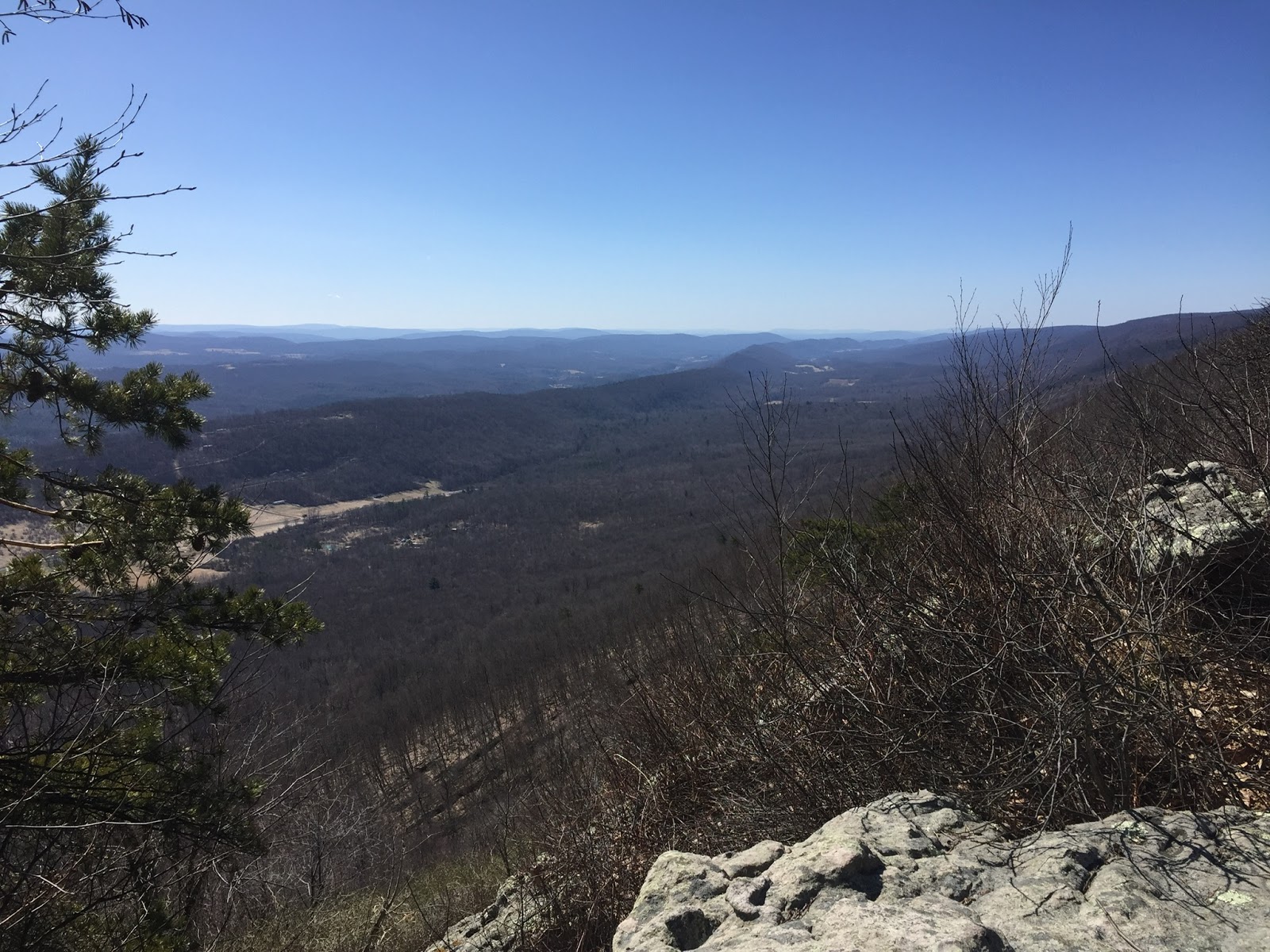
Aside from venomous snakes, what's the other drawback of hiking this trail in the summer? An almost total absence of water! There's never water up here on these ridgelines, where the cataclysms of eons past forced rocks to stand on end like sentinels, and the topsoil is thin. Of course, if you hiked this trail in the winter--or even now in the very early spring--you could always collect snow and use it for cooking and drinking. But in the summer, you might have to go down the mountain every now and again to seek out a brook or a stream. Click on this photo to enlarge it (as any photo on this blog). In the middle of this shot, you see a dark lower peak running many miles to the south. That's Warrior Ridge, and it's not even half as tall as Tussey Mountain. Between the two pinnacles sits Black Valley--where you can see several farm fields. I did not photograph them, but the birds of prey soaring above the valley floor were awe-inspiring and majestic. It always feels so strange to look down at birds in flight. I think I saw an eagle.

This was a marvelous hike. The wind blew hard and cold on the west side of the ridge. But on the east side, it was windless and the big rocks emanated a welcoming heat. The difference in temperature and comfort from one side of those rocks to the other was amazing.
I've neglected this blog in part because I haven't been keeping up with my life, and my hikes have become less frequent, closer to home, and less worth recording. Also, I'm just too tired to put the photos up and write about them. And yet, I've got lots of treks to post, and I'm way behind. I did have a frigidly cold backpacking adventure out in the Guadalupe Mountains of West Texas last month. I gotta put that up, too.