Friday, November 7, 2014

Fred Woods Trail, Elk State Forest

Although it's only a four-and-a-half mile loop, the Fred Woods Trail--in the Elk State Forest--is well worth a three-hour drive up from Pittsburgh.  Everyone who comes this direction hopes to see elk in the wild, and we were not disappointed, though I didn't get any photos.  They're such majestic animals, with their graceful antlers, their enormous girth, and their great self-confidence.
The Fred Woods Trail is certainly remote.  The only way to get there is to follow a narrow dirt track, known as Mason Hill Road, up the steep mountainside.  I don't know what you do if you meet a car or truck coming the opposite direction.  This trail has some of the best scenic vistas in the state, and it's surrounded by truly wild country--the Quehanna Wilderness.  The wooded hollows of Cameron County are so far-flung that they make a great place for cooking meth.  This region is famous for its meth in the same way some regions of the world are known for their wine or beer.    
But it's unspeakably beautiful.  The Elk State Forest is no stranger to me.  I hiked here pretty frequently in the mists of another life.  But my most recent visit was threefold: first, I've wanted to hike the Fred Woods Trail since first reading about it here; secondly, I wanted to do some research on the possibility of doing a "through hike" on the nearby 75-mile loop known as the Quehanna Trail; and thirdly, I was entertaining a visitor from out west who's always making deprecatory remarks about how easterners think any woodlot is a wilderness.  I wanted to humble him a little.
 He loved the Fred Woods Trail, with its elk. and grand rock formations, and long views, but he kept insisting that it was nothing compared to Utah.  He's probably right that the Pennsylvania Wilds can't compare to the empty places of the Utah deserts--at least not in terms of the vastness of unpeopled expanses.  But there are two things that keep me from taking an interest in Utah: impending water shortages and Mormons...and not necessarily in that order.
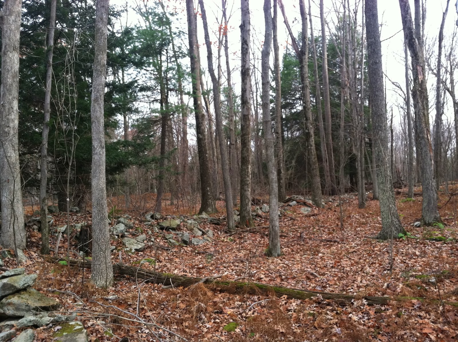
 Along an undramatic section of the Fred Woods Trail, we came across this interesting old stone fence, which was surely placed here when farmers were still trying to scratch a living from these stony uplands.
The rock formations along the trail are really amazing.  These boulders are about fourteen feet high on either side of the trail, which might be three feet wide.  The silence of this place is dense and otherworldly.  Ah, I miss the northern part of the state so bad.  Coming back here is a rare joy that reminds me of how much I lost when we moved to Pittsburgh.  It feels like someone I love has been taken away from me, killed in a senseless accident, sacrificed on the altar of expediency.  The wilderlands east of the Quehanna are even more vast and unknown.  I don't mean to be an ingrate, and I love my city very much...but sometimes I miss this place more than I can say.  If we only get one life--as I believe we do--then shouldn't we spend it living in the places and in the ways that bring us joy?

Ohiopyle

 I've never given Ohiopyle State Park the attention it deserves.  It's definitely the premier outdoor location for Pittsburghers willing to drive an hour and half.  It's got hiking, and backpacking, and kayaking, and whitewater rafting, and modern camping, and zip-lining, and rock climbing.  On top of all of that, it's a beautiful place with scenic vistas and lofty pinnacles.  The new park office and visitors' center is located right in the quaint little village of Ohiopyle, with its railroad tracks, its noisy waterfalls, its 19th century homes, and stores, and bars, which cater to the outdoorsy crowd.
Today, a friend and I hiked the first two-and-a-half miles of the Laurel Highlands Hiking Trail through its Ohiopyle portion.  It gains a lot of altitude in a very short distance, leaving your calves aching.  But the views between the second and third milemarkers--above--are worth the hike.  The deep silence is only broken by the rare, mournful whistling of a train, far, far below.

Wednesday, October 29, 2014

Last Lingering Traces of Color

The colors fade quickly once you get past the middle of October, bringing on fall's second phase: the grays and browns of old November.  A few leathery oak leaves will rattle and snarl from their treetops the whole way into April, when fresh buds push them to the ground.
My two favorite months are placed side by side, but otherwise very different from each other.  Two sisters: the Diva and the Spinster, October and November.
 I couldn't make it to the Laurel Highlands today, but the woods around Pittsburgh sufficed.  The only splashes of color that remain are way up high, the ruddy, muted reds and burnt oranges at the tops of the oak trees, and way down low, the yellow-brown of small beech trees, largely still in leaf.
 The wind blows in so hard from the flatlands to the west of Pennsylvania that autumn leaves get blown down early.  And yet, this is a lovely time, too.  The forest is more pungent now with the strong aroma of decaying leaves.  The skies tend gray, the sun visible only as a whitish sphere half-concealed in murky cloud.  The bugs are gone, and most of the birds have fallen silent.  My only companions on the trail today were a chipmunk and what looked to be a barn owl.
 Oh, and one human, whom I avoided.  I hiked back into the Pioneer backpackers' camp at Raccoon Creek--just because I only had three hours to spend and didn't know where else to go.  The camp is a little village of rustic wooden shelters, all spaced very far apart.  As I approached the familiar place--which I've always had to myself--I smelled wood smoke, and my heart sank.
 Some hardy soul was encamped in my favorite, most isolated site.  He sat on the deck of the shelter in his red fleece and gazed at me from afar, as if to dare me to take the spot from him.  I was almost tempted to do it, too.
 A part of me wanted to go talk to the guy.  "Woodsing" is a solitary pleasure for me.  I have friends, but I almost never hike with them.  I go to the trees to escape people.  And it was for that very reason that I wanted to talk to this guy.  He clearly wanted to be alone, too.  I wanted to know another woodland loner like myself.  How many of us are there?  How do we interact when our paths cross?  Are we natural enemies?
 I occasionally meet other hikers on the trails, though I typically pick areas that are lightly traveled.  But this was different somehow.  This guy was making the forest his own.  He had a fire going.  He looked as if he'd spent the night there by himself.  But I passed him by without a word.  In my heart, I knew that we both wanted it that way.
Against all odds, a few brilliant maples still hold onto their leaves with shades of green still close to the trunk.  Next week I'll be hiking up North, where the leaves are surely almost all down.  (The tree in this photo isn't a maple, just a hanger-on.)

Thursday, October 23, 2014

Forbes State Forest: Lick Hollow

The lovely, lonely, little-known Lick Hollow Picnic Area is one of only two picnic areas in the Forbes State Forest.  It's a beautiful place, and serves as a trailhead for some great treks out onto the Forbes, including the one described just below to the uber-cool Pine Knob Overlook.
The picnic area is closed after Labor Day, but if you park at the gated driveway on US-40, you can hike in on foot.  I love having places like this all to myself.  Honestly, I'm not sure that people take picnics anymore.  It's kind of an old-fashioned thing, but I could see coming back here with the family and a basket--not that my wife would ever go for anything like that.  It's just so pleasant, and scenic, and sunken into sheltered little valleys in the forest floor.
State forests are a very different thing from state parks.  Whereas park lands are more or less protected--despite Governor Corbett's best efforts--the state forests are "working forests."  Like our national forests, they're "multi-use areas."  This means that they're open to logging and fracking as well as all the regular recreational uses like backpacking, hiking, hunting, and picnicking.  
The age-old conundrum: Two roads, yellow woods...
In a state forest, you can expect fewer amenities than in a state park, but the trails still tend to be well marked and maintained.  This is a truly lovely place, unphotographably beautiful, with rocky streams, huge boulders, steep cliffs, and deep wooded hollows echoing with "the sound of many waters."

Forbes State Forest: Pine Knob Overlook & Trail

The two-mile trail to this overlook from the Lick Hollow Picnic Area was steep in places, the sharp rocks slick with wet leaves.  My original plan was to drive to the overlook, but I was turned back by low-hanging clouds that made the mountaintop too foggy to negotiate.  This photo shows Uniontown, PA, and surrounding countryside, 1,200 feet below.
I actually arrived at the top of Chestnut Ridge, the low mountain range just east of Uniontown, at about 9:40am.  It was so socked in with clouds that I had to rethink my original mission.  Visibility along Skyline Drive, at the summit, was only about ten feet.
Some people call this little range "Mt. Summit," but that's just because they don't know what a summit is.  There's an interesting old hotel called "The Summit Inn" just atop the ridge on US Highway 40, "The Old National Pike."  They probably assume that the hotel is named after the hill, when in fact the hill is named for the chestnut trees that used to grow on its flanks.
The Forbes State Forest map recommends that hikers give themselves four hours to complete the roundtrip hike from the picnic area to the Pine Knob Overlook, pictured here.  I did the roundtrip hike easily in two and a half hours without even hurrying.  Over the course of the trek, you rise 700 feet from where you started, up, up, up into the clouds.
The Forbes exists in four or five major segments that are not contiguous, not to mention many smaller patches of woods sprinkled here and there throughout Southwest PA.  The Chestnut Ridge section is further west and south than the areas where I've been hiking lately.  It's the westernmost line of hills in the Appalachian range--though geologists will tell you that it's not a part of the Appalachians.  The range looms majestically above the little borough of Uniontown as you're approaching in your car.  With clouds at their peaks, you'd almost think the hills were much taller than they really are.  On overcast days, it makes Uniontown feel almost like Albuquerque, where the Sandias stand stark to the east, sometimes lovely and protective, sometimes menacing and dark, but ever-present. 
The woodlands on the mountainside were silver with mist, the tree trunks black.  I felt like I was traveling in a magic land or a movie set.  When I finally arrived at the overlook, the clouds nearly obscured the view entirely, but began to clear up after twenty minutes.  They blew like milky ghosts over the rocks, the steam of the world pouring over the highest ridge between here and the Ozarks, far, far away.

Saturday, October 18, 2014

Perspective

"The trees, the flowers, the plants grow in silence.  The stars, the sun, the moon move in silence.  Silence gives us a new perspective."
~Mother Theresa


Friday, October 17, 2014

Linn Run and Laurel Summit State Parks

 Linn Run State Park is beautiful but tiny.  There's a small village of cabins for rent, two picnic areas, a few miles of trails, and that's it.  It's mostly just the pretty woodland adjacent to Linn Run Road, pictured above, but it also serves as the jumping-off place for backpacking adventures into this segment of the Forbes State Forest.
And yet, Linn Run State Park is deluxe compared to Laurel Summit State Park.  This second park is exactly what its name implies: the summit of Laurel Ridge, the long, low hill that stretches southwest to northeast from Maryland almost to Johnstown.  Laurel Summit State Park is only six acres in size and consists of nothing but two parking lots, a primitive latrine, and a picnic pavilion, seen here.  Like, Linn Run, this place is little more than a trailhead for some great hikes in the Forbes.  I secretly collect state parks.  We've got 120 in the state, and these tiny sections of the forest make two more to add to my collection.  (To wit, there are four state parks named "Laurel," and they're all on this ridge.  There's a Laurel Hill State Park, which is big and beautiful and featured somewhere below on this blog.  There's a Laurel Ridge State Park, which is mostly just a long, narrow collection woodlots that have been patched together on the ridgeline of this hill so that the storied Laurel Highlands Hiking Trail can pass through trees instead of strip mines.  There's a Laurel Mountain State Park, which apparently consists mainly of a ski lodge and slopes.  And finally there's this little place, Laurel Summit State Park, a very remote picnic area.)