Wednesday, October 8, 2014

Laurel Highlands Trail: Bridge over PA Turnpike

At long last, on the most perfect hiking day of the year, I made it to the Laurel Highlands Hiking Trail's bridge over the Pennsylvania Turnpike, also known as Interstate 76, the nation's first freeway.
I've driven under the bridge many a time, and I've always wanted to stand on it and gaze down at the busy world below, all the distracted drivers rushing between Philadelphia and Pittsburgh.
 The bridge appeals to me because it's the intersection of two parallel worlds: the forest and the four-lane...which is soon-to-be-eight-lane in this segment. 
 The forest world is constantly encroached upon by the world of hurried people.    
 And yet, the trail, its bridge, the forest in all its hidden beauty--these things are all visible to the travelers below (and vice versa) but completely inaccessible.  It's like two parallel universes.  Most drivers don't even glance up to notice the bridge.
 The Laurel Highlands Hiking Trail is very popular.  I met two couples hiking it separately today.
 One pair told me they had just discovered the old Laurel Hill Tunnel on an abandoned section of the Pennsylvania Turnpike--not to be confused with the well-known segment of abandoned turnpike near Chambersburg, where "The Road" was filmed.  These two have been hiking this area for years but had never been able to find the tunnel before.  
Strangely, they found that the tunnel was enclosed with Quonset huts at the mouth and had enormous air conditioning units attached to it.  Someone is using it for something, controlling the temperature and humidity inside.  The couple suggested that it might be the Department of Defense.  The old Laurel Hill Tunnel is easy to find on Google Earth.

Wednesday, October 1, 2014

Forbes State Forest, Felgar Road Revisited

 Felgar Road turned me back the last time I traveled it, last week.  That unspectacular misadventure is described in the post just below.
 And so, I returned today for a rematch.  The upland forests are lovely right now and rich with the memory-laden scent of October leaves.  This is my favorite month, such a pensive time of year, when memories of days gone-by drop silently around me like so many leaves.
 Fall awakens old yearnings in me.  It makes me long to walk off into the wilderness on some kind of quest, and so Felgar Road was an ideal destination.  The top photo shows the road as it runs alongside the Pennsylvania Turnpike.  On this open stretch, it feels almost like a service road, but I think Felgar Road is actually older than the pike.
 You follow the road a frighteningly long distance into the steep woods only to re-emerge next to the Turnpike.  The Texans and other frackers are digging a pipeline that runs between the two roads, and in places you can see the fatsos in their orange vests right through the trees.  This photo looks west along the Pike.
 Once the track becomes impassable to vehicles, you get out and walk, abandoning the car at one of the rare pull-offs.  It's only then that you discover these amazing views out over America's first superhighway.  Notice the semis traveling the Pike.  This is looking east.
 The traffic screams in the valley below, but there's a smug isolation up here on the peaks above it all.  As others speed at breakneck velocity from one place to the next, I stand apart from it all, surrounded by golden leaves like some medieval saint enshrined in stained glass.  An observer, unseen by the travelers far below.
 Along much of the trek, the "road" was little more than a grassy track along the ridgeline above the Pike.  I suspected that Felgar Road would eventually rejoin the frackers' new pipeline road at some ugly juncture of ruined forest.  This turned out to be the place.  In theory, even this dangerous-looking thoroughfare is open to hikers.  Trail signs point to it, saying "PA Turnpike / Route 31."  But I didn't really find it very appealing.
 Today's hike was really cool, despite the fact that I did not escape traffic noises and I did end up seeing frackers in the forest--both things that I deeply despise.  The world was just so bright with autumn colors and the views so vast.
 You would think I'd have been disappointed.  Not only did I suffer industrial incursions into the forest, but I also missed my hiking goal.  
 I had hoped to trek from Felgar Road onto the multi-use trail that leads to the Laurel Highlands Hiking Trail's footbridge over the Turnpike.
 I intended to stand in the middle of the footbridge and watch the interstate traffic passing down below.  But I got sidetracked by the hideous new pipeline road, with all its noise and florescent-vested Texans.
And yet, despite missing my goal, I ended up bushwhacking through some scenic if nondescript meadows and woods, like the places pictured here.  It was a day of great discoveries.
 There were good mountain views in spots.
 And in the end, I accidentally discovered the Marshall Fields Trail, which called me further and further into the woods, away from the Turnpike.
 The Marshall Fields Trail is a beautiful little lane that snakes through autumn trees.  At a certain point, I came upon a lesser lane that split off and led to this clearing.  Is this one of the "Marshall Fields"?  I wonder what it's for and why someone clearly comes out here to mow it.
 But alas, when you hike an hour and a half from home, you don't get as much time on the trails as you would hiking thirty-five minutes from home.  I had to hurry back to the car so that I'd be back to the house before the school bus dropped off the kids.
 I had some anxiety about traveling back uphill on the deep, loose gravel at this far eastern end of Felgar Road.  I didn't know if my car would end up spinning out on it.
Here, again, is a more traveled segment of Felgar Road as is runs along the Pike.  I met some young guys in a red pickup who told me they were out on the forest looking for firewood.  They asked me if I worked for Powdermill, which is strange.  One of the trails out there is called "The Powedermill Loop."  I wonder what it is.

Wednesday, September 24, 2014

Forbes State Forest, Felgar Road

 The Forbes State Forest is becoming my regular hiking grounds, which Raccoon Creek used to be.  It's further afield than Raccoon, but so much wilder and more beautiful.  I like the mountainous terrain, too, and the beautiful upland farm lanes.  
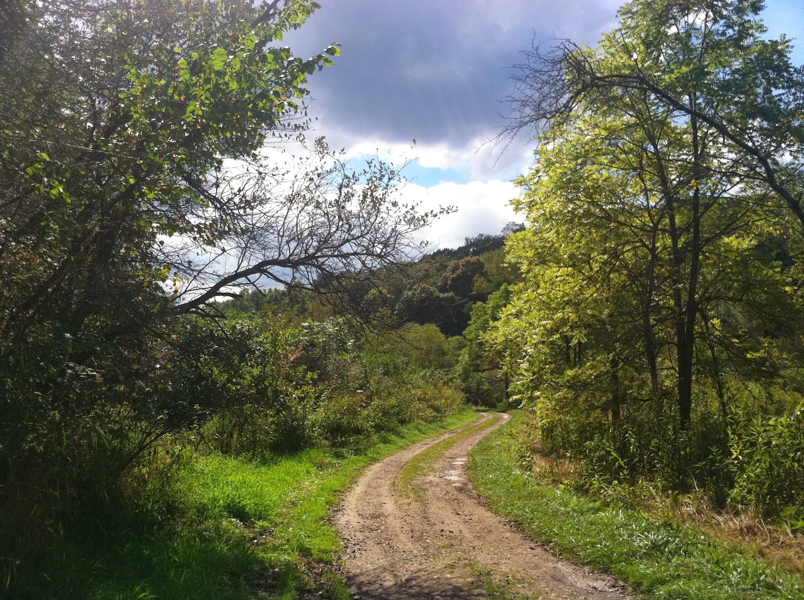
After waking up at Kooser State Park this morning, I ventured out early to explore a place I'd found once while poring longingly over my treasured maps.  A little gravel way called Felgar Road runs parallel to to the PA Turnpike for a while then disappears deep into the Forbes State Forest.  Felgar Road is an unwelcoming place.  The few private properties along the road have menacing signs, warning of video surveillance and prosecution.  It's kind of an eerie neck of the woods, albeit pretty on a sunny, blustery fall day.  Where the road ends, a network of intriguing trails begins.  According to the map, Felgar Road is gated near its eastern end, and has to be traveled on foot to the trails.  But it comes out at an appealing spot, near the new footbridge where the Laurel Highlands Hiking Trail crosses overtop the turnpike.
It was indeed a very strange drive, with the wind blowing hard in the autumn forest.  The further I went, the narrower and more difficult the lane became.  It also wended gradually uphill.  At about the time I'd gone a few miles and reached the Ritter Cemetery--above--I allowed myself to get spooked.  My fuel gauge was telling me I had less than an eighth of a tank left, which was strange since I'd begun with a quarter tank.  I turned tail and went to get gas and hike another part of the forest, near the beautiful Linn Run State Park.  But I regret chickening out, since a part of me knew all along that my fuel gauge was giving an erroneous report due to the uphill grade.  I'm definitely going back to Felgar Road.  And soon.

Kooser State Park, Revisited

The Spillway at Kooser Pond
The last time I visited Kooser State Park, in the Laurel Highlands, I bemoaned the fact that its beautiful four-acre pond is polluted with industrial sludge, and it's beach is closed.  Nevertheless, I really liked the place.  The dense forest, the rustic old buildings of rough-hewn timbers and stone, the general layout.  It just reminds me so much of Twin Lakes, too.
The first day of fall in the Laurel Highlands
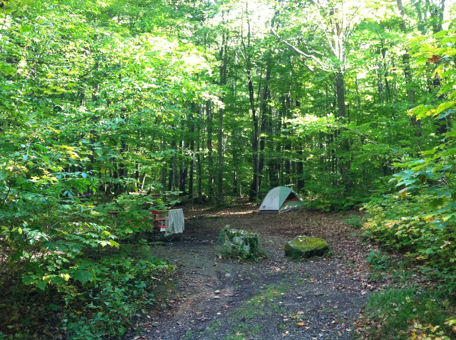
I liked it so much that I scheduled a time to go back there with my kids to spend a night in one of its three wooded campsites.  It didn't work out, but since I'd already paid for a night, I decided to go by myself, and it was so cool.
A peninsula on Kooser Pond--mostly for trout fishers
I'd never camped alone before, and I found the prospect of it a little intimidating.  I'm not scared of bears or coyotes.  There's just something a little vulnerable about sleeping alone in a tent along the roadside.  Backpacking might be a little less creepy since you can hide your campsite far from view.  But in a conventional campground, you're on display, sleeping and exposed.  
The west end of the Kincora Trail is very, very steep
I even get the willies sleeping out in the back yard.  But this was really nice.  My goal, when I camp, is always to hear an owl, which has only happened once, at Twin Lakes, Kooser's more isolated doppelganger up north.  But last night at Kooser, I actually heard a screech owl!
Along the Kincora Trail
Of course, I also heard coal trucks screaming by on the PA 31.  The highway noises didn't let up until about 11pm.  But if you come emotionally prepared for the traffic racket, it's not so bad.
The little lane leading up to the three wooded sites
There's something almost holy about spending a night alone in the woods.  Outside my little ring of firelight, it was incredibly dark.  I always forget the beauty of the night skies away from urban light pollution.  There were so many thousands of stars.  I wish I had the kind of camera that could film them.  In fact, I wish I had a decent camera, period.
My solitary wilderness home, site 33
If I return to camp at Kooser, I'll always get site # 33.  It doesn't have much level space for a tent, but it's the only site in the whole park that backs onto the woods.  And of the three wooded sites, it's the only one that actually feels secluded, since the other two overlook the main campground.  The Laurel Highlands are so beautiful right now: the golden sunlight, the autumn trees, the beautiful old farms with enormous, ornamented barns.  The deep green of the meadows contrasts with the changing trees.  I spent a few hours hiking but a few hours, too, just driving down those lovely country lanes, lined with yellowing trees and split rail fences.  The wooded ridges are always in the background, now tinted in red, and orange, and yellow.

Saturday, September 20, 2014

Fall

 It feels like fall.  The green leaves on most trees have a yellowish tint, and some few trees are already in full autumn leaf.  This is my fifth fall back in Pittsburgh, and I'm always reminded that it's not as spectacular down here as it is up in the northern reaches of the state.  In the Pittsburgh region, fall is when the trees are completely overtaken by the blight that they've exhibited all summer.  The leaves turn brown around the edges, then wither and drop without ever providing any kind of autumnal splendor for the aesthete.  There's some hysteria about the hard winter that we're supposed to have this year, though weather reporting has become so sensationalist.  Power outages, people frozen in their homes, snow up to the second floor windows.  I'm not usually into mass hysteria, but I am looking into some heating alternative in case of a long power outage...like temporarily installing a small wood-burning stove and running the stovepipe out a window, like some sort of Jed Clampett.
But it's a lovely time of year, even with the impending winter and the lesser natural beauty of Pittsburgh.  I like the "retraction" of the fall.  Everything is in retreat.  The yard furniture is getting pulled inside.  Parks and beaches are empty.  Campgrounds are still open, but they're spooky for lack of campers.  I'm actually going on a solo camping trip for the first time ever soon.  I reserved an isolated, wooded campsite at Kooser, so my daughters and I would have something to do while my wife was away on business.  Turns out that the kids aren't going to be able to go with me, so I decided to go alone.  It's a little intimidating, the idea of sleeping alone in the woods of an empty campground.

The photos were taken in the remote western half of Raccoon Creek.  I returned there recently, though frequent trips to the Laurel Highlands have spoiled me.  Raccoon can't compare.

Saturday, September 6, 2014

Oil City, PA

Oil City, PA, is formerly the home and headquarters of both Pennzoil and Wolf's Head Oil.  Both companies have been sold and resold since I was a kid, and neither one has much of anything around here anymore.  The fossil fuel industries are greedy and inhumane.  They pillage and leave, and this ragged old borough bears all the marks of a discarded boomtown.  And yet, this place is situated nicely in the valley of the Allegheny River in its more northerly reaches.
 Oil City is my hometown, and this house was our home.  Built in 1900, it was in our family until about 2003.  It doesn't look bad from the street, but it's needed a roof for as long as I can remember.  Whoever bought it never re-roofed it, and now I suspect it's unlivable.  Oil City is a great town to buy a huge, decaying Victorian and spend your life fixing it up.  
In this photo, there's an old yellow bucket in the trash heap in the yard.  That's one of my grandpa's Pennzoil buckets.  He used to have stacks and stacks of them all over the house, and even under this wrap-around porch...which is no more.  There was a porch swing in the back, near the bay window.  Though the house is three stories in the front, it's a full five stories in the back, counting a sub-basement (or wine cellar) with a walk-out entrance into the steep woodlot out back.  

The whole town looks pretty rough these days, though it's especially sad to see our home in this condition.  We kids always believed the place was haunted, but the stories--the ghost stories as well as the true childhood memories--none of them really matters anymore.  A homeplace can fall into ruin, but it has planted itself in the hearts and lives of those who once loved it, and in that way it re-creates itself in all the other places of their lives.  I had the occasion to pass again through Oil City en route--circuitously--to New York for a beautiful early autumn cruise to the Maritime Provinces of Canada: New Brunswick and Nova Scotia.  Both places are unspeakably beautiful, though I only got a handful of unsatisfactory photos.  It might be interesting to take a "sacred places pilgrimage" of Canada's east coast.

Friday, August 22, 2014

Laurel Highlands Hiking Trail

In many places, the Laurel Highlands Hiking Trail runs through very narrow stretches of public land--passing through state forests, state game lands, and state parks, as well as a few short jogs across private land.  It's a backpacking trail that runs a full 70 miles along the crest of the Laurel Ridge from Ohiopyle to an area near Johnstown.  
I just chose the wrong neck of the woods.  I picked a trailhead that was within an hour and a half of my house, but the woods there really was just "a neck."  It was a narrow little north-south finger of woodlands, encroached upon by an enormous coal operation to the east and to the west.  The noise was overwhelming, the conveyor belts, the indeterminate grinding sounds, the huge trucks bearing rocks, the beeping of heavy machinery running in reverse.  I'm sure the LHHT runs through some much more pleasant areas than the one I picked.  The road to the trailhead was being guarded by a coal miner.  He told me I wasn't permitted to use the road--despite the fact that it's a public thoroughfare leading to public lands!  But he was a nice guy.  He called his supervisor, and they decided to permit me access as far as the trailhead.  Who are they, a private industry, to give or deny permission to a citizen wishing to travel on public lands?
I hope to report on the LHHT at greater length in some future post.  I only hiked a short distance along the trail before all the racket sent me to seek mountain silence elsewhere.  I'm sure I'll be coming back here someday to do a backpacking trip along the ridgeline.  The LHHT is kind of like the Appalachian Trail for backpackers who only want to spend a few days in the woods.  I did come across one of the shelter areas, which was a pleasant little ghost town of really nice Adirondack shelters with fireplaces--pleasant except for all the industrial noise.    

As I was coming up on the LHHT from a connector trail, I saw a band of about fifteen backpackers passing in the forest in front of me--about 100 feet away.  None saw me.  They were silent as a Seneca war party, slipping like phantoms through the dark and noisome forest of withering leaves.  Fall comes early up here in the highlands.  By mid-August, the leaves are already beginning to give up the ghost.