Friday, March 3, 2023

Laurel Highlands Hiking Trail, Route 653 Shelter Area

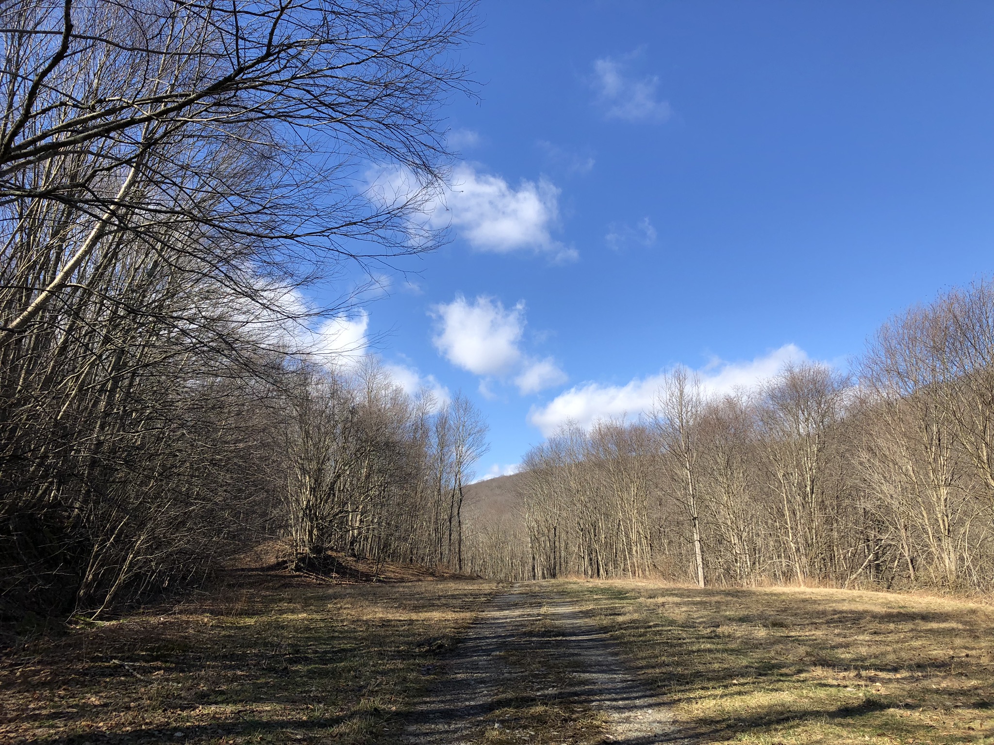
It was cold and windy in the Laurel Highlands on this 3rd day of March.  But the misty gray countryside was lovely all the same.  I had to take today off because I'll be working on Wednesdays for a while.  Since the summer, I've been planning a thru-hike on the Laurel Highlands Hiking Trail.  It's only 70 miles, and there's generally plenty of water along the way.  I've calculated the trip for 6 nights, passing over 2 of the 8 shelter areas without spending the night.
Camping along the trail is only permitted in the designated shelter areas, and I've explored most of them on simple day hikes.  But for some reason I'd never been to the Route 653 shelter area, despite the fact that it's really at the heart of the trail--close to the park office and the cross country ski area, with its very cool warming hut.  At one point on today's trek, I ducked under a cozy rock formation to take shelter from the wind and frigid rain, where I looked at maps and read a little.
Here's the warming hut, just off Route 653.  You can see the rack for skis and the pile of free firewood.  It's unlocked, and you're welcome to take shelter inside.  The lights are on timers, and they pop on when the door opens.  There's a restroom with running water.  Build a fire, and make yourself at home.  The Laurel Highlands Trail goes right through here.  
This is the inside of the warming hut.  There's a separate building down the hill a ways, a "concession stand."  Of course, there's been so little snow this winter that the concession stand was closed and probably has been most of the year.  I wonder how busy this place gets?  The state is operating a pretty nice little setup if you're into cross country skiing.  I could be mistaken, but I don't believe I know anyone who is into it.  In these days of ragged gray winters, it would be sad to love cross country skiing.
Of course, skiing is not my interest.  I came mostly to scope out the nearby shelter area and to find the overlook in the post above.  Let me just admit this: there are two shelter areas along the Laurel Highlands Trail that have a slightly spooky feeling for me, and I almost dread spending the night alone in them: the Turnpike Shelter Area and the Route 653 Shelter Area.  Both had a strangely ominous feel to me.  In the case of the 653, there were two Adirondack shelters with tarps flapping loudly in the wind.  It felt a little like those old Western movies where the hero rides into a little western town that's eerily quiet; there are signs of life, but no one is seen.  Where is everyone hiding, and why?  Are they all...dead?  I made me wonder if there was someone inside those shelters--at midday--unaware that their tarps were whipping and blowing like flags.  I checked out the shelter that I'd planned on reserving, and it is indeed the best.  I also went to make sure there were no expired hikers inside either of the two shelters with flapping tarps.  Thank God there were not.  Nothing ruins a great day in the woods like coming across a corpse.  I guess someone just left the tarps for the next person to use.

Wednesday, March 1, 2023

Link to Cameroon Photo Dump

I’ve long held to the silly and arbitrary rule that this blog’s reach does not extend beyond the borders of the Keystone State.  That’s why I’ve got the Snow & Jaggers Online Annex, where I publish my many travels around the country and abroad.  Here’s a link to photos from my two trips to Cameroon back in November and December.  HERE.

Saturday, February 25, 2023

Laurel Highlands Trail, Route 31 Shelter Area

A friend and I have taken to doing winter backpacking trips along the Laurel Highlands Trail.  We get one of these Adirondack shelters, gather lots of firewood, attach small tarps in the big gaping openings on either side of the chimney, and have ourselves a merry old time in the wintry forest.  No humidity, no bugs, no other people making their noise!  (No one to complain when I play my pan flute in the chilly forest nights.)
Along the Laurel Highlands Trail, you're required to stay in one of the official camping areas, and you have to reserve your site beforehand, either for a tent or else one of these cool shelters with a fireplace.  See, it's kind of cozy inside these shelters.  Of course, it can get plenty cold, even with a fire going--hence the tarps.  In fact, the day we arrived it was an eerie 70 degrees.  Overnight the temperatures plummeted to 24 degrees.  When we woke up the next day, it was frigid.  That day did not see temps rising above 34 degrees.  On our second night, we kept the fire going all night long, which made it bearable, even though ice formed in my water bottle, which was all of 10 feet from the fire.
Oh, what I wouldn't give for a little place like this in the woods--though this cabin has a slightly creepy air about it.  
You're not technically supposed to stay two consecutive nights in these shelters along the Laurel Highlands Trail.  They're primarily for "thru-hikers" who do the whole 70-mile trail in one long trek.  (I am going to be one of them someday.)  And if it had meant depriving someone else of a place to stay, then we definitely would not have stayed two nights here.  But I looked online beforehand.  Aside from us, there was no one staying in the Route 31 camping area.  You see very few people on the trail in February.  So my friend reserved the shelter in his name on the first night, and I reserved it in my name on the second night.  The park ranger did stop by, and he knew exactly what we had done, but didn't seem to care.  
We hiked mostly around the Blue Hole Division of the Forbes State Forest.

Evitts Mountain and the Mason Dixon Line

Here's the pleasant if unspectacular view from the top of Evitts Mountain, looking southeast into Maryland.  Actually, the best way to get to this spot is by following the trail from Maryland into Pennsylvania.  Although only Maryland goes to the effort of putting in and maintaining a trail, all the views are on the Pennsylvania side of the Mason Dixon--which you cross in the forest at the summit.
This shot looks northwest into Pennsylvania.  There's a sad homemade monument to someone called "Jenny Girl" in this photo.  I wonder what her story is.  Every place has many stories; it was the story of Evitts Mountain that brought me here.  At Maryland's Rocky Gap State Park, you can follow the Evitt's Homesite Trail up to the summit.  About halfway up the mountain are the remains of an old homestead from the early 1700s.  It's said to have been the home of a hermit who moved out to the furthest frontier to be alone when he found that no woman would have him--especially not the one he loved.  All there really is to see is an old well.
The hermit's name was Evart, and the mountain is named after him, with a slight variation in spelling.  Here's the old historic Mason Dixon Line marker in the woods beside the trail.  The "M" is for Maryland.  It's hard to believe that Maryland was ever considered part of "The South."  Today it's a proud little suburban state that touts its several modest attractions and manages to be a lot more progressive than its neighbor to the north.  In a way, Maryland has it all: beaches, forests, mountains, at least one big city.  But in another way, all the stuff it has is on the slightly mediocre side.  Gritty Baltimore is its one big city; these hills are its idea of mountains, but I've heard its coastline is nice... 
It's the Belgium of the states, an in-between place where cultures have come to clash, where wars have been fought, where silent battlefields bear witness to a violent past with monuments and solemn, hushed lawns where many died.  Historic sites, sprawling, wealthy suburbs, screaming interstates, a few carefully preserved patches of woods, rail trails, a small but busy beach.  That's Maryland.  I like it.  
Along the Evitt's Homesite Trail, the Mason Dixon Line marker is a little less impressive.  To get the views, you have to keep hiking a short distance into Pennsylvania, where the trail cuts rightward and down the mountainside.  How many an enslaved person made for this arbitrary political line, this artificial and invisible boundary, only to discover that their so-called "owners" were allowed to pursue them even once they got past this line?
The marker does have rather a grand air about it, sitting as it does at the summit of the mountain and overlooking two states.  In the summer, there would be little to see here.  Just leaves.
Looking again from Pennsylvania into Pennsylvania.
And again.
You see this signpost along the trail in the Maryland state park?  This is how a state with a modicum of pride goes about the art of existing.  They've got their classy, historic state logo at the top, but adapted, with an oakleaf to make it more outdoorsy.  They've got the trails all nicely marked and color-coded like the maps.  This is Maryland: modest, fussy, orderly, proud.  They've got good signage and an identity that they try to make visible.  Driving along the interstate, they advertise "scenic overlooks," which rarely amount to much, but at least they're trying.  

Wednesday, February 1, 2023

Mt. Davis, Pennsylvania’s High Point in Winter


At 3,213 feet above sea level, Pennsylvania’s highest point is a mere 4 feet higher than England’s Scafell Pike.  It’s nice to be a little taller than someone else—speaking as a guy who stands on the short side of average.  However, England’s tallest hill definitely cuts a finer figure than Pennsylvania’s.  This was a pleasant 2-mile out-and-back hike in the snow at 17 degrees!  Here’s the westward view from the top.


Our state’s high point is in the Forbes State Forest, and it’s probably visited mainly by those collectors who tour the high point of every state in the country.  On one hand, you’ve got a mere rise of some 450 feet in Delaware—which is maybe a little taller than Florida.  (It’s generous of me to mention Delaware because I do not recognize its statehood; it used to be Pennsylvania’s coastline, and it consists of a mere three counties, two in high tide.)  But can you even reach Alaska’s Denali peak without doing a technical climb with snowshoes and ice picks and mountaineer training?  Mt. Davis’s summit is covered in trees.  Without the lookout tower, there would be no views at all.  This is the eastward vista.


And this is looking south.  I actually didn’t “ascend” Mt. Davis except in a car.  My little Kia couldn’t navigate the treacherous, snowy back roads that lead to the base of the mountain, where there is a long trail to the top.  Instead, I drove to the picnic area, located one mile away from the lookout tower, and I hiked from there.  With the winter sun so bright, it hardly felt cold at all.


This view looks north, where the upland rolls on for many miles.  That’s really all Mt. Davis is: an upland hidden among Amish farmlands and ramshackle old villages with ornate little churches, immense pre-Civil War houses, and weathered political signs still in the yards supporting the villainous Doug Mastriano—the failed Republican candidate for governor who denies climate change and intended to outlaw all abortions whatsoever for any reason.  (We really dodged a bullet, and not by as wide a margin as I’d like.)


There was not another soul to be seen anywhere in the woods today, although there were a few sets of footprints in the snow.  Those footprints did not go to the top of the lookout tower.  It was cold and gusty up top with ice and snow encrusted on the frigid steel.


Ice formed in the grates to create a temporary thing of beauty—which I suppose all things of beauty are: temporary.  It’s some comfort that all hideous things are, too.


Ice also collected in the bare branches of the treetops at the summit of the mountain.  It was good to have my crampons and gloves this time around.  The footing was a bit treacherous in places, frozen and slick.


This is my second and—frankly—probably my last visit to Mt. Davis.  I came here with a group of guys many years ago in the summertime.  It’s just not beautiful enough or interesting enough for another return trip.  The countryside around here is scenic, with lots of forests and contour-plowed Amish farms.  Nearby Meyersdale has a maple syrup festival in March, which is interesting.  But the world is big and time is short!  On to other things!  

Friday, January 27, 2023

Bear Cave Mountain, Westmoreland County

According to family legend, January 26--my birthday--always has the most dismal weather of the year.  And this year it was indeed pretty dismal.  I decided to do a solitary peak-bagging trek in the Allegheny Mountains near the town of Derry.  There was a 2,505 foot ridge out there that had never been claimed by any other peakbagger.  In fact, it wasn't even named on the peakbagging site.  Once again, I parked my car at the trailhead, 1,500 feet below the ridge, where it was only just barely winter.  But despite the fairly warm temps, it was an exceedingly dark day, 32 degrees, and strangely spooky in the unfamiliar forest.  There are overcast skies and then there are dingy, almost eerily dark skies.  This was the latter.
It seems that this area is private land that's been opened to hunting and is overseen by the PA Game Commission.  From the village of Millwood, I followed Mill Street to the place just past the last house where the street becomes a narrow path.  You could probably drive most vehicles on this narrow track, but soon enough you reach a sign saying that all motor vehicles are forbidden.  From here, it's a 3.2 mile uphill climb to the summit of the mountain.  
Once you get up around 2,000 feet above sea level, winter's icy grip on the landscape is firm.  I regretted the fact that I left both my gloves and my crampons at home.  Why am I forever underestimating the differences in weather between Pittsburgh and the hills?  Ah, but see how much nicer this is than the gray and brown woods in the first and lower photo?  
The higher you go, the deeper the snow, the stronger the wind, the colder the temps.  It was probably 25 degrees up on the ridge with snow pelting down from the skies and gusts above 30 miles per hour.  Following the dirt track that Mill Street becomes--always sticking to the most-traveled route when you reach a juncture--you'll arrive at a saddle crest at 2.1 miles with a gated road off to your left.  You know what gated roads mean, don't you?  Fire towers!  And fire towers mean high points.  Follow the gated road another mile or so to the summit.  See this radio tower looming menacingly through the mists?
I was proud of the map-work and guess-work that went into making this 53rd birthday trek a success.  I know there was once a fire tower on this ridge because maps call this track Fire Tower Road.  I assume the old tower was torn down when these new radio towers went up.  Or else the old fire tower was further down this road than I was able to go.  Walking was slow in the snow, and my hands ached without gloves.  Besides, my time up top was limited because my daughter was scheduled to take her 4th driver's exam at 3:30pm back in Pittsburgh.  (Poor kid, her 4th failure, too.)  I had to hurry back down to the gray Novemberlands to get her to the license bureau.
Because I've always known my birthday to be a day with such terrible winter weather, it was nice to escape to the highlands again on that day to find fearsome conditions up on the top of Bear Cave Mountain.
Actually, I assume this peak is called Bear Cave Mountain.  It was not named on any map, and it was unnamed on the peak-bagging website where I log my climbs.  And so, so I submitted it as Bear Cave Mountain, and they added it to the site.  But I only got the name from this sign on the chain link fence around one of the towers.  They did already have listed a peak called Bear Rocks some six or seven miles north of here, and I have half-wondered if they weren't confusing things.
A perfect January day on Fire Tower Road at the top of Bear Cave Mountain....
If not for rush hour traffic, this place would only be about an hour and twenty minutes from home.  It's a nice escape, and I might want to go looking for the other supposed ridge around here that's named after bears.
I'm grateful to the landowner for making this place available to wanderers, wayfarers, explorers, and even hunters.  It was good to get a dose of wintry white, and the chill on the mountaintop was worth the hike, even if there were no views.  Actually, there was one spot where I thought there would probably be views on clear days, which this day was not.
I did make two recent trips to Africa, and I'll need to put those photos up on the annex site soon.

Wednesday, January 11, 2023

Sugar Camp Hill, State Game Lands 42

At 2,910 feet elevation, Sugar Camp Hill is no slouch--for these parts.  This was my first time back in the woods since--when?--October?  It was a joy to return to the Laurel Highlands for a few hours.  Whenever you see the word "sugar" attached to a place name in the Northeast, it always means maple syrup.  There must have been a large scale maple syrup processing camp on this mountain at one time.  It would have hummed with life in February and March: sweet wood smoke, the scent of maple on the cold breeze, the lilting music of harmonicas and laughter.  It was almost 50 degrees down in the lowlands today, but a semblance of winter still reigned in the highlands east of Pittsburgh.  Of course I brought the wrong car; I had to park it along Boy Scout Road, near Boswell, and hike into State Game Lands 42 to reach the summit of Sugar Camp Hill. 
Oh how I miss winter! The generous, monochromatic, Bergmanesque winters of my childhood.  But a thin ghost of January still holds an exiled court up in the highlands east of Pittsburgh, like some grand queen who has been forced into hiding.  November's gray forces have occupied all her old domain except these remote upland holdouts.  The 21st century has seen dull November conquer everything between Halloween and Easter.  Our winters now are bland limbos, sluggish and colorless.  Instead of the snowy, cold, brilliant winters of long ago, now we have a chilly, rainy, soggy gray and brown season that lasts about five months.  Insipid November with its oatmeal skies and its 40 degrees!  I actually used to like November for its melancholy, before its expansionist tendencies overtook almost half the year.  Once-powerful winter is now reduced to guerilla tactics, issuing the occasional brutal counterattacks like the savage blast of deadly cold we saw just before Christmas.
But they are the lashings-out of a wounded animal.  At least we did have a white Christmas in 2022.  But such brutality is an act of desperation, the last refuge of the enfeebled combatant.  Like some bloodthirsty African warlord, winter comes out of hiding just long enough to lay waste to a string of villages, sparing no one, before hurrying back to its refuge in the hills.  Everyone hates the cold, I know, but I do love January, real January, which hides up in these sheltering heights.  I'd like to construct a winter retreat and call it "The Januarium."  Ponder the rare beauty of disappearing things, unfashionable things.  Consider the beauty of scarce or even persecuted things, things that are hunted and haunted and ghostly like the remains of winter.  I recall my grandfather in his woodworking shop or in his vegetable garden; my mother at her sewing; an organist at the bench, skillfully making those grand old pipes sing.  Basement woodshops, backyard vegetable gardens, maternal sewing, organ music: all of these are disappearing from the world. But they were lovely in their time, and they are especially lovely in their passing.  

These hills will soon be unequal to the task of harboring winter, the exiled queen.  They're too low.  As climate change accelerates, they'll be no match for the encroaching dullness, the sameness, the gray monoclimate.  Winter will flee from here like the elf queen Galadriel abandoning Lothlorien.  Her nearest refuge will be the higher ground of West Virginia and far upstate New York.  She will be entirely gone from here.