Wolf Benchmark is a mountain just inside Pennsylvania, near the New York border. The ascent to the summit begins on public land--the Allegheny National Forest--but passes onto unmarked private property without warning. The summit, standing at 2,205 feet, is definitely on private property because I found a dilapidated old hunting camp up there. (More about that below.) This ferny meadow is the tippy-top. There are no views.
I parked about 2.5 miles away and walked the entire length of quiet old Forest Road 174. It's a gated gravel lane, so there was no traffic--not that there would have been traffic without the gates. This segment of the national forest has been heavily exploited for timber. Also, the trees are so tattered and bedraggled by the near-drought conditions that affect much of the country this summer, not to mention the extreme heat, which finally began to relent yesterday and today. The raspberries were fruiting.
It was such a joy to walk an old forest road back here in my beloved Allegheny National Forest. When I finally get a new phone, it will have a camera worthy of this lovely scene: about half a dozen butterflies of different colors and patterns, on a patch of purple thistles. The forest was perfect today, 74 degrees and not at all humid.
So. Who gave the order to put a stop sign here at the end of an unmarked, unmapped forest road where it intersects with a gated forest road in the middle of...the forest?
This modest view is brought to you by recent tree-harvests on this segment of the national forest. I've been wondering how a mountain gets a name like "Wolf Benchmark." What kind of benchmark does a wolf need? Maybe even a wolf needs standards by which to measure its lupine progress. But I googled it and found that there are a lot of mountains called "benchmark." The summit must have been used as some sort of navigational landmark in earlier times.
Speaking of views, this is about the only view you get on Wolf Benchmark, and it's not at the summit. This is taken from a harvested section of the forest on the flanks of Wolf Benchmark. Pictured near the center of this photograph is Tuscarora Mountain in New York State. Why is it that the peaks get suddenly taller, and sharper, and more inspiring as soon as you get inside New York? I mean really, right at the border, things become instantly more dramatic. There's a reason. Let's talk about it.
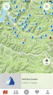
Look at this screenshot from my peak-bagging club's app. The orange mountain in centerfield is Wolf Benchmark. The blue circle is me, approaching the summit. The horizontal line that crosses the photo is the New York / Pennsylvania border. Notice something strange? There are about 30 peaks just across the border on the New York side and only one peak on the Pennsylvania side. At first I thought this was just another example of living in New York's shadow--which New Jersey and Pennsylvania have done for centuries. I thought maybe people had reported the peaks in the Empire State but didn't even bother with the Keystone State. Not so. There really ARE more peaks right up to New York's southernmost border. And they really do become infrequent the moment you cross the border southward. Here's how it all went down:
In eons past, the glaciers were depositing low mountains all over southwestern New York State, long before anyone had a name for the place. They reached that place that would someday become the Pennsylvania state line, and one glacier said to another, "You goin' in there?" The second glacier said, "I'm not goin' in there. Are YOU goin' in there?" The first glacier said, "Ima stop right here." A third glacier spoke up and said, "C'mon guys. It's safe for now. Gettysburg and the 2016 election are still a long way off. Things aren't gonna get spooky and weird down there till white people evolve out of the primordial ooze and then devolve into swing-state voters." The first glacier held his ground, quite literally. "I'm boycotting that place on principle. Ima stay right here and melt. Them backward sumnabitches can go unglaciated. They won't even notice." And they didn't...until The-Blogger-Formerly-Known-as-the-Snowbelt-Parson returned to the snowbelt and uncovered their ancient scheme.
Here's the derelict hunting camp at the summit of Wolf Benchmark, just beyond the ferny meadow that's shown in the first pic, above. It's kind of a nice little place.
I took the liberty of stepping inside.
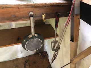
Someone put a fair amount of work into slapping this shack together. They installed a woodburning stove and insulation and glass windows. It's sad to see it so disused.
Looks like this really was an off-the-grid place where guys came to get away from their wives.
Ah yes, the carved glass ashtray. This really is a beautiful object--solid, heavy, time-worn. I'm not sure who needs to tap their cigarette ash daintily into an ashtray when the whole shack looks like a dirty ashtray. I liked this ashtray a lot. But you know the rules of urbex and rurex--which is to say, exploring abandoned buildings, urban or rural: Leave nothing, take nothing, break noting. Even if the owner never returns, this ashtray does not belong to me.
Beware of dog? It oughta say, “Beware of Wolf,” because this is Wolf Benchmark!


