Monday, April 24, 2017

Off Trail in the Hickory Creek Wilderness, Allegheny National Forest

Here's a post that I just put up on my old blog: A Pittsburgh friend and I were planning a trip to the incomparable Dolly Sods Wilderness Area in West Virginia, but the forecast down there predicted rain all weekend.  My friend wanted nothing less than "wilderness," so I sold him on Hickory Creek--where the weather was going to be chilly and cloudy but otherwise dry.  
If by "dry" you mean "no rain," then it was a perfect time to go to Hickory Creek.  But if your definition of "dry" includes not being saturated all the way up to your knees at all times, then we did not have a dry hike.  This guy had a book I'd never heard of: Bruce Sundquist's Guide to Hiking the Allegheny National Forest.  And using this book, he suggested that we do the lesser-traveled trails that follow the streams and old railroad beds along the northern part of the wilderness area.  Little did I know (until after we were already good and lost) that Sundquist's book was published 27 years ago.
Strangely enough, for all my years of exploring and blogging about the ANF, I had never been inside the Hickory Creek Wilderness Area.  And so, it was with a real sense of excitement that I ventured northward once again to the Allegheny National Forest, the hallowed ground of my past.  I liked it that there was a witness in the car to see just how confidently I drove straight from Pittsburgh all the way to the Hickory Creek Trailhead--without so much as calling upon Siri or peaking at a map.  Yes, that old forest is still such a part of my soul.  I could have wept tears of joy and loss as I felt it folding in around me as before.  But alas, there was still a "witness" in the car, and so tears were out of the question.  
Of course, "wilderness areas" are designated by Congress, and they come with their own special rules.  The Hickory Creek Wilderness Area has a single old 12-mile loop path that is pretty well established in most places.  But the Forest Service is allowing the trail blazes to fade in order to enhance the wilderness feel of the place.  This can create confusion for hikers.  My friend and I arrived at 6:00pm of a Friday evening.  There was only one other car parked at the trailhead, and we decided to take the road less traveled.  Instead of the Loop, we settled on the old railbeds along the East Branch of Hickory Creek.  C'mon, it's a "wilderness area," but it's still Pennsylvania, right?  You can't really get lost.  If you lose your way, you go downhill and find a stream, or a road, or a railroad, and you follow it to a house, right?  Besides, the whole wilderness area is only 20 miles square, which is about 1,000 acres bigger than Raccoon Creek State Park.  There's no way to get lost, right?  Right?!
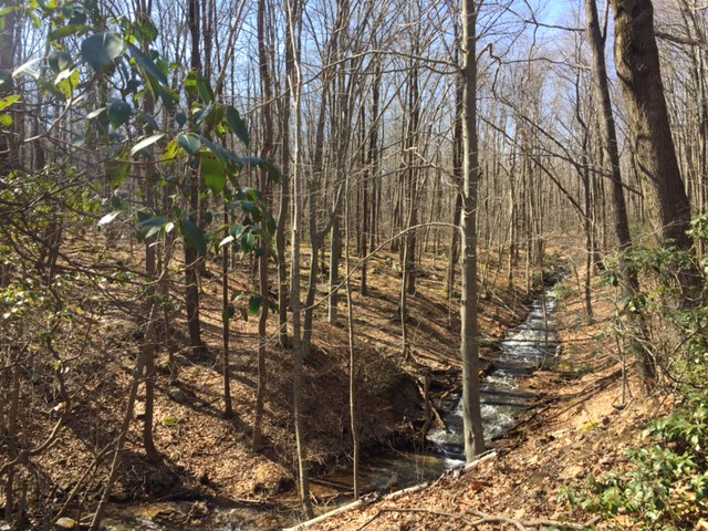
We got so lost.  From the connector trail that runs from the parking area to the Loop, we took a right that went downhill.  My friend needed water, and we assumed (correctly) that there would be a stream down there.  We also assumed that the downhill path was a certain faded old trail that, in reality, only exists on paper in a book that came out in 1990.  We spent the first night camped on the edge of the clear, cold, lovely waters of East Hickory Creek, a deep, rushing stream that is shaded by hemlocks and beeches.  My friend admired my hanging of the "bear bag" so much that he flattered me into taking a picture of it.  Perfectly 12 feet high and 4 feet from the tree's trunk.  We had a fire and slept in late because of the unnecessary exhaustion of our citified lives.
Off to a late start the next day--Saturday--we began to look for landmarks mentioned in Sundquist's book: a beaver pond; an old logging camp; a bridge; an old railbed from logging days.  Things just got weird from there.  The stream has a wide floodplain in places, and most of the trek was incredibly boggy, requiring frequent crossings over the creek.  We hopped between tufts of grass in standing water; we forded the stream on slippery fallen trees in search of higher ground.  We frequently lost our footing and plunged ourselves into the frigid water.  The beaver pond was lovely, though, and when we came upon it, we took it for evidence that we were on track.  Though Sundquist doesn't say what the "old logging camp" is supposed to look like, I didn't expect it to feel so much like...Leatherface's hunting cabin.
This neglected old cabin might be all that's left of the logging camp; I don't know.  A sturdy but very old metal bridge connected it to a cleared area on the south side of the creek.  The place creeped my friend right the hell out.  (He's originally a Long Islander and very Italian, not your standard outdoorsman.)  As we approached it to ask for directions, he began calling out, "Hello?  Is there anyone there?"  I tried my best to look folksy and laid-back as I strode up to the backdoor, scrambling to remember the Western Pennsylvania dialect of my childhood: the slight whine, the slurred diphthongs, words like "nebby" and "jaggers" and "you-ins," which was our north country equivalent to Pittsburgh's "yinz."  It turned out that we didn't need to make friends with Leatherface.  We didn't have to convince a hostile, gun-wielding hoarder that we were non-threatening.  We didn't need to hide the fact that we both supported Bernie Sanders.  Leatherface wasn't home...yet.
Not to perpetuate unfair stereotypes about rural people--I'd still be one myself if I had my way about it--but for some reason, all the detritus surrounding this cabin made me think it was owned by a serial killer.  I suspected--rightly--that we had strayed onto a small bit of private land that juts into the Allegheny National Forest.  None of the old logging camps ever left so much debris and garbage to rot among the trees.  There was the carcass of a 1930s model car, old furniture, empty propane bottles all shot full of holes, clay pigeons, old oil drums, and a lot more.  I noticed as we high-tailed it back to public lands that there was a yellow rope drawn over the bridge as if to block entrance to the cabin's debris-yard.  When we would come skulking back this direction the next day, after a loud, sleepless night, we would see that the yellow rope had been drawn off to one side.  Leatherface was home....
It didn't detract from the creepiness factor that this place has a sign on the front: "Trail's End."  We wandered far, far down the old railroad grade--frequently losing sight of it--in search of Jacks Creek, where we expected to hike back uphill to the main loop trail.  But the further we went, the swampier it got.  We were both soaked almost to our waists from failed creek crossings and discouraged that so many landmarks described by Sundquist were no longer in place, or else so deeply buried in the overgrowth that we'd missed them.  At a certain point, after searching long and hard for Jacks Creek and wondering if every tiny rivulet pouring down the hillside might be it, I prevailed upon my friend to turn back.  It was a stinging defeat.  The old railbed led us back through the dismal marshes.  The contours of the railroad ties still showed beneath the grasses.  Little beech saplings snagged our packs and slapped our faces as we retreated in shame.  It was tough going through otherwise lovely country.  Down along the streams, it could almost have passed for Alaska--but in my distress I ended up taking few photos.  We put down camp for the night at a little streamside site that we'd noticed on the way in, a place that felt chilly and dank and anxious.
We were discouraged and VERY tired from difficult trekking with almost 40 pounds on our backs.  But the brook laughed soothingly beside us.  The night was cold but the fire hot.  It turned out to be a nearly pleasant evening, despite having missed our goal.  (Why do we have to be so goal-driven?)  My tent felt like a nest, where I read by the light of a book lamp and slept soundly from 9:00pm until 1:30am--which is almost a full night's sleep back in the overworked suburbs.  We were wakened at 1:30 by an ungodly noise, like the sound of a really, really loud speedboat accelerating, except that it maintained the same rate and noise level from start to finish--for about ten seconds.  It sounded like an alien death ray had just obliterated Leatherface's cabin--which wasn't far off.  Maybe a sonic boom.  There was rapid gunfire late into the night and the distant beat of heavy metal music.  The few times I dozed, I had troubling dreams about Leatherface coming to find us and public speaking engagements back in the city that I hadn't prepared for.  
The following morning, we did end up finding a little rail-spur, described by Sundquist, that leads uphill along a certain stream near the beaver pond and back to the main loop.  The spur line only goes a very short distance up, then disappears altogether.  The trail he describes is long since gone, and we had to use a compass to bushwhack due south and uphill.  In fact, we almost missed the main trail as we crossed over it, which would have been disastrous.  But we did see it and cut east to the beginning of the Loop.  Even Jeff Mitchell's 10-year old guidebook was a little outdated, and we worried whether the connector trail would indeed lead us back to the parking area or if it was some other trail altogether (like the Tanbark?) until a band of Ohio hipsters came strutting by and told us we were on track.  When we got to the parking lot at 12:30 on Sunday, it was filled with cars.  All in all, I went to the Hickory Creek Wilderness Area in search of silence and peace.  Instead I got an adventure.  But that's alright.  My life lacks adventure just as much as it lacks silence--so it was a great trip.  I'd highly recommend going off trail in this beautiful place, but first invest in some waterproof socks, bring a topo map and compass, and don't camp anywhere near Leatherface's cabin. 

PS: If you'd like to look into this trek, follow this link and check out the map.  You can see that the northern area along the East Branch of Hickory Creek is marked as an old railroad line.  

Friday, April 7, 2017

A Rainy Day in the Forbes State Forest

I took a wrong turn while hiking the Forbes this past Thursday.  I was saturated from the constant rain, the muddy trails, the waterlogged ground.  Hiking with wet feet is the worst.  
 I'm planning a backpacking trip for later this month, and I was scouting out a good site to set up camp the first night.  But the rain was almost unbearable.  Somehow it seemed to pass right through my poncho.  I decided to take a detour and dry out at a cabin I know that sits open.  
But approaching the cabin from this direction was guesswork, and I guessed wrong.  I ended up following an old forest road way back to a lonely place with good views of the distant mountains.  This third photo is where the road ends.  Why it even comes here, I don't know.  There's been some timber cutting out here--hence the clear views--so maybe it's an old logging road.
After getting home and looking at a better map, I see that I was actually quite close to the cabin, and would have arrived there if I'd turned left instead of right at the fork in Weaver Road.  But it turned out alright.  The rain cleared up for about an hour and a half, offering nice vistas out over the Laurel Highlands beneath glowering gray skies.  Click on the top photos to see the misty blue mountains on the horizon.

Thursday, March 23, 2017

I'm So Bored with Raccoon Creek...

I'm so bored with Raccoon Creek, so stupefyingly weary of the place.  But on days when the wife is out of town--which is pretty much most days recently--I don't have time to go any further afield because I have to be home before the school bus.  Today I just needed trees to help me think, and Raccoon sufficed.  That's all it ever does; it suffices...which is better than not.  
I also needed trees to test out my new hiking hammock, a Christmas gift from my in-laws.  While I don't love the idea of going to the woods to lie in a hammock, I gotta admit, it was nice.  Find a lonely spot out on the forest, far away from any trail, hang the hammock, and kick back in the sunshine with a book...rocking gently in the breeze.  It's lightweight and collapses down into a tiny pouch.  I tell you, this could really revolutionize the way I spend  my days off.  

Saturday, March 11, 2017

Return to Roaring Run

A lesser hike that I've had brewing on a back burner of my imagination for a few years begins near the Laurel Highlands Hiking Trailhead close to PA-31.  I parked there and did a majorly long loop, maybe 10 miles with frequent stops, spending a full eight hours out on the trail.  My philosophy is that a good hike makes you happy to see your car--just like a good vacation makes you happy to go home.  This was definitely a good hike.
From the trailhead, follow the LHHT south as it runs a little too close to the narrow lane known as Fire Tower Road--which is the road you parked along.  Where the trail tries to cross the road, I exited the LHHT and made for another parking area at the Cherry Trail--a grassy old road, now a snowmobile trail, that runs through scenic forest.  As I was crossing Fire Tower Road, a creepily silent white van with the Seven Springs Resort logo nearly ran me over.  It was quieter than a golf cart, and I only knew it was behind me because of the way its tires crunched on the gravel.  The ski resorts are surely suffering this year...
 This is the Roaring Run Natural Area, a large and lovely "protected zone" of the Forbes State Forest.  Camping is not permitted here, but happily neither is fracking.  I visited a different quadrant of Roaring Run a few years ago--seemingly in a bad mood--and that trek is described here.  Traversing really beautiful streams at the valley floor, I came eventually to the Beltz Trail, which led me in time to a Boy Scout camp known as "Conestoga-Buck Run."  It was a bit of a surprise to see this old blockhouse looming through the trees near the trail's end.  
 This Scout camp is a huge place, but they don't seem to mind hikers passing through.  From here, you follow the road into the Scout camp and eventually into Laurel Hill State Park before returning to the Forbes.  If you follow the road all the way through the camp, which seems to go on forever, you come at last the the Bobcat Trail on your right.  This will take you back north again to the Beltz.  Sadly, I believe Scouting is in decline due to the fact that electronic devices and sports hold more appeal to most kids than trees, patriotism, and civil religion.  I've never been a great fan of Scouting just because I don't like the whole ethos of "God and Country."  But I think it's a better way to spend a childhood than playing video games.  This place must accommodate thousands of campers.
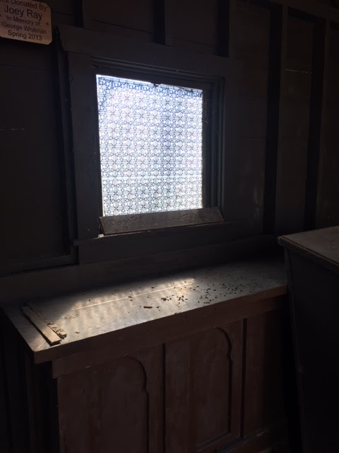
The Hagan Chapel caught my attention.  (You know my fascination with religious architecture.)  Even out here in the wilds, this scant little structure--just a covered chancel with outdoor seating--mimics humanity's best attempts to reach for the Sacred, or the Other. Notice the patterned glass in the window, making the sunlight that passes through it seem otherworldly.  Notice, too, the Gothic design in the altar front, hinting at the great cathedrals of France and the curved arches of Moroccan palaces.  Even here in the forest, you can conjure a poignant awareness of lofty things.
After following the Bobcat Trail north and back, you take a left back onto the familiar Beltz Trail.  From there you turn right onto the long, long road back to your car: The Red Pine Trail.  This grassy old lane runs due north along the valley wall, and it too is a very long road.  In time, perhaps a very long time, you'll see the condos of the Hidden Valley Resort looming through the trees to your right.  Click on this photo to see what I mean.  The sight of buildings comes as both a relief and a disappointment: as a relief because you were wondering by now if you were on the wrong trail, and the presence of the resort means that you're good (there was a fork a ways back, and the trail's not blazed); as a disappointment because it means that you're not as remote as you'd flattered yourself that you were.
The road I've chosen through life is grassy lane--for the most part.  It's certainly not a freeway, or an interstate, or a turnpike.  I wanted a less crowded way through the world, a quieter path.  And though it has led me to splendid places--to Europe, and Africa, and Asia--it has mostly allowed me to travel more slowly, to enjoy the sites, to avoid the hustle and the hassle of this world's busier thoroughfares.  I should never complain that luxuries and companions are few along this way, for this was my choice.  I knew that this was the spartan way when I struck off in this direction, long ago: the solitary way.  And yet, a whole day in the woods made me feel almost--lonely.  I was so happy to make it back to my car and, in time, to the paved-over world.  Weary and sated, I haven't slept so well in months.

Thursday, March 2, 2017

Big Bend National Park

No, this isn't Big Bend--the legendary national park in the mountainous Chihuahua Desert that shares a border with Mexico at the Rio Grande.  This is just Hillman State Park, the reclaimed stripmines where I bushwhacked today.  But I did just get back from a FANTASTIC trip to Big Bend, and you can see a few photos of that backpacking adventure by clicking HERE. I officially hate Texas.  Any state that executes mentally retarded prisoners is an evil, evil place.  Most of the ignorant frackers that are tearing up our verdant Pennsylvania countryside are Texans, too.  And the vast majority of Texas is ugly as hell.  But Big Bend?  Wow.  Just check out the photos.  Wherever you see a "river" in the photos, it's the Rio Grande, which is actually about the size of Chartiers Creek; one side is Texas and the other side is Mexico.  I highly recommend a trip to Big Bend--before the Trump builds his wall.  But Big Bend is way, way down south, 85 miles from the nearest town, which is Marathon, Texas, population 430.


Monday, February 13, 2017

Shawnee State Park Revisited

So, I've decided that Shawnee State Park (the one in Pennsylvania, not Ohio) is one of my favorites.  The lake is its centerpiece, of course, and it's got a beach and all that aquatic stuff.  But the park also has a really nice campground and some pretty good trails.
Plus, it's in the "Ridge and Valley Province" with its low ridgelines (see in the distance) and its broad, lovely valleys.  This is truly scenic country, the old Pennsylvania of myth and legend, where contour-plowed hillsides run up the lower reaches of the mountains, and big, prosperous farmhouses of ages past stand squat and graceful along winding roads.  Most of the barns are well kept and marked with hexes.  
I had a bit of a prejudice against Shawnee because the first few trails I walked in this park were maintained with a lawnmower, and the woods were remarkably southern with lots of low pines and almost no understory.  But today I found that the park also contains typical eastern mountain forest, too, as in the second-to-the-last photo.
There are scads of historic markers along all the roads down here.  I'd like to stop and read them all, but time is never on my side.  And of course, here in the south-central part of the state, you've got to have covered bridges.  This is the Colvin Bridge, located on a public roadway on the edge of the park.
The bridge is seen here from within the park.  Notice the big redbrick farmhouse sitting among the trees to the right of the bridge.  The thing is enormous, probably six bedrooms.  This is Trump Country, to be sure, which is a horror and an embarrassment.  But it's also historic and beautiful.
And here's the Forbes Trail, which is said to more or less follow the route that General Forbes cut through the virgin forest from Carlisle to Pittsburgh in a successful bid to route the French from the Ohio River Valley.  Carlisle was the westernmost town before the mountains back in the 1750s. For that matter, it still is...
Even though I had a whole Saturday to myself to do whatever I pleased--the wife and kids out of town--I didn't have time to do all the exploring that I wanted to do at the park.  Sadly, I was also preoccupied on this visit, dwelling on stress-inducing things that were to take place later in the weekend.   I hate to have things hanging over my head, and it did dampen my experience of an otherwise wonderful park.  I'd like to say I'll go back soon, but two hours and fifteen minutes each way is just so far to drive.  But I do love the countryside out this direction.  Everything out here is so much neater, and cleaner, and the views are so much more expansive.  You forget just how claustrophobic Pittsburgh is until you get into a place like this.

More Cabins in the Woods...and a Few Ruins

Somehow winter was still making a stand up in the Laurel Highlands, even though Pittsburgh has had one protracted November, with only one significant snowfall. This is the main road through Linn Run State Park and on into the Forbes State Forest.  
On this trek, again, I had the place largely to myself, and so I found myself trekking past more of these little snowbound cottages and cabins within the bounds of the park.  Too bad they're closed for the winter.  I'd think winter would be the best time to come up here and hole up.
 The Adam Run Trail passes practically through the backyards of some of these places...though I did sneak up to the edge of the bluff to look down onto the properties.  
The trail also passes by a few ruins of old cabins, chimney stacks and foundations marking the spots.
I've wondered about this cabin before.  It sits right off the road that passes through the park and up the mountainside to the summit, which is on state forest land.  It seems derelict and a little spooky, but my guess is that somebody still uses it.
The Brant Trail, which is the second trail I took, winds up behind that selfsame cabin, and here it is as seen from above and behind.  The ascents are pretty glorious.
This menacing little shack sits along the trail with "No Trespassing" signs in the doors and windows.  With all respect to the rural poor, it looks like a scene from the movie Deliverance.
You have to stray off the Brant Trail to get to the summit of the hill that you're skirting.  It comes up here to Old Rector Edie Road, which I've encountered in other hikes.  I liked the silence and snowy fields with the steep, woody drop unseen to the left.  
Returning to the Adam Run area, I walked along the creek and discovered this spectacular old ruined stone house.  Just look at this place!  I wonder why it was just allowed to rot away like this.  It stands on a low bluff above the stream, surrounded by rhododendrons and hemlocks.