Tuesday, May 12, 2015

Laurel Mountain State Park: The Abandoned Ski Resort

I've seen this place at the northernmost edge of my Linn Run hiking maps, and I've always thought about coming here to see what was left of it.
It felt like an old episode of Scoobie Doo.  An abandoned ski resort at the end of a gravel road in the mountains.
Every year, skiers ask whether Laurel Mountain will reopen, and it never does.  As far as I can find on the Web, this place hasn't been operational since 2005, and even then it wasn't much used.
I love ski resorts in the off season.  This is the third one I've explored when no one else was around. Blue Knob was fun in August as was a certain ski resort near Mt. Ascutney in Vermont in October.
And yet, it was a little eerie.  The wind was blowing hard, making the trees creak like complaining voices and creating the constant illusion that someone is walking behind me.
There are two nice ponds here at Laurel Mountain, and an air of complete abandon.
The lodge is large and derelict.  It's at that point in its abandon where it could go either way: Someone takes it and runs with it fast, or it slips quickly away into ruin.  Strange how quickly things made with hands can disappear.
The mountain air was crisp and the views almost alpine.  One reason I wanted to trek into the old ski resort was to see the Laurel Highlands from the cleared downhill slopes.
I'm not exactly sure why this body of water creeped me out so thoroughly.  It's out on the edge of the resort closest to the Forbes State Forest--the way I hiked in--and it's surrounded by debris: old parts to ski lifts, an abandoned truck, even an antique kayak, seen above in the fifth photo.
But the mountains were lovely from here, with clouds scuttling over the ridgetop, creating an ever-changing interplay between darkness and light.
There are privately-owned cabins all along the road to the ski resort, although the road passes through the Forbes.  My guess is that the state leases the properties.  
This one looks cool...in a strange sort of way.
For the official website of the Laurel Mountain Ski Resort, click this incredibly unhelpful link: http://www.skilaurelmountain.com/

Wednesday, May 6, 2015

Let the Current Carry You

I paddled the Chartiers Creek oxbow from Heidelberg to Carnegie again today.  What a great ride!  It's not exactly scenic.  The creek passes between glowering old mills in various stages of decrepitude.  It runs very near Interstate 79, which screams with traffic, and under a variety of rusted out bridges.  And yet, the water was cool and dappled with sunlight.  There was a great blue heron, a lot of wild ducks, and a gaggle Canada geese that I just kept chasing further and further downstream.  I'm learning the ways of that stretch of river.  I'm discovering where the deepest passages flow over the gravelly streambed.  I didn't bottom-out once this time, and the water levels are pretty low.  It took 20 minutes to travel from home, tie up the kayak at Heidelberg, then drive over to Carnegie and park; 20 minutes to hike up the railroad track back to the kayak; 50 minutes to let the currents carry me to Carnegie and my waiting car; 20 minutes to get back home--out and back again in two hours.  I feel like the rockstar of solo kayaking.  It's so weird that you can walk down the main street of Carnegie with a bright orange kayak on your back, and no one even glances at you.

Wednesday, April 29, 2015

Kennerdell Overlook, Venango County

The land of my ancestors.  I was visiting graves here recently.
This is the Allegheny River, where it wends through the great north woods.

River Ridge Farm, Venango County

The Samuel Justus Trail is a rail trail that runs along an abandoned stretch of railroad between Franklin and Oil City.  It follows the Allegheny River in its northern reaches.  When I was a kid, this was still an old railroad bed, but now it's the playground of provincial yuppies.
The Allegheny River is beautiful up here, not as big as it is in Pittsburgh, but wilder and cleaner.
About two miles from the Franklin trailhead, going toward Oil City, you reach the former estate of Joseph Sibley, an erstwhile politician, congressman, judge, and mayor of Franklin.  This stone pylon in the woods marks the edge of his old estate.
The estate--known as "River Ridge Farm"--has long since been divided up and sold into smaller parcels.  But it was vast in its day.  If you click on this photo and look closely, you can almost see the Italianate mansion near the top of the hill, in the forest.  (For a better picture, click here.)  It now belongs to some fundamentalist Christian sect.  After passing out of Sibley's hands, it was owned for a time by the "White Fathers," an order of missionary priests who worked in Africa and retreated here.
But there are three grand houses on the estate.  One of the lesser houses can be seen in this photo.  I believe this stone structure was the guest house.  There is also a large redbrick house for the farm manager.  In the 1960s, my father almost bought the farmhouse, but thought that it was a little too remote.  Instead, he bought a big townhouse in Oil City.  Notice the oil derrick in the foreground.  The grounds of the estate, which were once fields and gardens, are now planted in derricks.
Joseph Sibley was placed under house arrest at one point, and he was not allowed to leave his mansion on the hill.  In its heyday, this was the entrance to the estate from the railroad tracks.  Sibley had his own private railroad station here, and he whisked away frequently to New York, Harrisburg, and Washington, DC.  The roof that is seen through the archway is to a small tower of carillon bells that played several times each day.  They've been silent for many years.
President Woodrow Wilson visited Sibley here at River Ridge, and legend claims that it was here he drafted his "Fourteen Points" at the close of World War One.  This grand estate with its imprisoned master used to loom large in my childish imagination...always across the river and in the woods, but visible from where I was. 

Urban Exploring: The Abandoned "First Baptist Church of McKeesport"

The First Baptist Church of McKeesport was founded in 1820.  Its majestic building, seen here, was constructed in 1904.  My guess is that more than a handful of homeless people are using the old parish hall, in the basement, as sleeping quarters--though none were present when I went through.
 See the brambles growing on the windowsill.  An old book I found online stated that in 1939 the congregation had a membership of 908.  Of course, McKeesport's economy suffered an almost total collapse in the 1980s.  The nearest I can figure, the structure has been vacant since 1990. 
 McKeesport is a little Detroit, with less crime.  I located a 2005 Post Gazette article saying that a black Baptist congregation was attempting to purchase and refurbish this building.  (Apparently that didn't work out.)  The same article estimated that the church had been abandoned for at least fifteen years.  It's really surprising how little information I can find about the church. 
 The strange dots on the ceiling are some kind of fungus.  So much of McKeesport is derelict, but most of the grandest churches are still hanging on, or they've been re-purposed as other things.  The lovely old synagogue up the hill from this place is now a Pentecostal church.  And the old onion dome of the Eastern Orthodox church is still standing tall.
 In its day, this dome was surely a stained glass skylight.  Perhaps it was covered and back-lit when it began to leak.  
 This is the chancel, which would have had a pulpit in the dead center.  All the pews and other furniture have been long-since removed.  The name "Baptist" refers to the fact that this church only baptizes adults, and they do it by dunking them entirely under water.  To the far right of this shot, you can see the strange cistern-like configuration where this rite took place.
 I did find the festering carcass of a raccoon here in the sanctuary, which creeped me out a little.  Whenever you see a dead raccoon out in the open, you can be pretty sure it was hit by a car or died of rabies.  I heard other large rodents scrambling around above the ceiling, and I really didn't want to meet up with any rabid raccoons.
 Look at the elaborately detailed scroll-work on these columns.  This building was truly a landmark.
Baptists are largely branded as right-wing wackos nowadays--like the Westboro Baptist Church, which marches around with signs that say, "God Hates Fags."  But the Baptist faith also has an old and venerable academic and liberal tradition--one that values beauty, and reverence, and social justice.  This progressive wing of the American Baptist Church has largely been eclipsed by conservatism, but it still lives on in places like Riverside Church in New York City and Colgate Rochester Divinity School.  But alas, it does not live on in McKeesport.

Wednesday, March 18, 2015

Forbes State Forest: More Discoveries on the Mountain Streams Trail

It was a strange day to be in the forest.  Spooky and dark, it felt more like a gray ghost of Novembers past than the hopeful spirit of March and Springtime future.  But I had business to attend to back in the Forbes State Forest.  On my last trek, below, I accidentally bypassed the parts of the Mountain Streams Trail System that would lead me onto the high flank above Indian Creek and deep into the forest.  Here's a shot of that fast-moving stream with the trail climbing the mountainside on its banks.
The temperatures were barely into the 40s, but the wind chill made it feel much colder on the upland hillsides and ridges.  Soon enough, the loud gurgling of the brook gave way to the chaotic screaming of the turnpike.  It may have been the noise, but all along this hike, I had the uncanny feeling of being watched.  I kept casting a downhill glance over my shoulder to see if there was some vagrant or stray animal trotting along behind me.  It didn't help, either, that a hapless backpacker was killed just a few days ago on the Appalachian Trail in Maryland when the wind downed an old tree onto his head.
In October or June, this stretch of woods is probably a lovely place...and it has a melancholy beauty in March, too.  But the seasonal gray joined with the turnpike racket to make it strangely eerie.  I loved this long wooded ridge that accompanied me all the way to 2,600 feet elevation, where I had to turn around in order to hurry home in time to meet my kids off the bus.  To the left of the trail, as you ascend, there's always something noisy: a stream, a turnpike.  But to the right, there's this deep valley, with its ever-present ridgeline on the opposite side.  Unseen in the chasm below is the remote watercourse called "Little Run."  It's a tributary of Indian Creek, but there's no trail through that valley, which makes it an immensely appealing place for a lonesome camp-out.
 Indian Creek really is a mountain stream, swift and swollen with snowmelt and spring rains.  It tumbles down the side of this steep hill, over rocks and fallen trees.  I saw a herd of about twenty deer leaping through the gray undergrowth.  And upon my return to the car, I had to pluck two deer ticks off my clothes and skin. 
 Closer to the trailhead on Skyview Road, before beginning the long climb upward, the stream dashes past this odd stone wall.  Click on the photo to see it.  I couldn't ford the creek in order to go investigate.  The water was moving to deep and fast.  But it looks too thick to be the foundation of a barn.  I'm guessing that it's the remains of an old flour mill.  This stone structure probably used to hold a water wheel over the stream in order to grind grain into flour.  Surprisingly small bodies of water were often used for mills.
On the way home, I stopped near Donegal to get some coffee, and I saw this strange convoy of VWs, below.  They were en route from California to Boston and apparently advertising some kind of beer.  The Mohawk haircuts are rows of wheat, so it must be a wheat brew.  I don't drink anymore, so I don't know.  They've got that little gray car surrounded.

Thursday, March 12, 2015

Forbes State Forest: Mountain Streams Trail System

Ah, sweet March, the deceptive month!  It draws you out into its golden air with birdsong and early spring promises.  The trails are all slippery with hard-packed ice and mud, and only the earliest of incipient little buds are beginning to appear in the undergrowth.  But it was 50 degrees today and sunny.  I had to hustle back down the the Forbes to spend my day off.
There's nothing really all that spectacular about the Forbes State Forest.  It's got some nice overlooks and pretty streams.  But for the most part, its trails run a little too close to human habitation for my comfort.  I went into the Mountain Streams Trails System with an old map that I printed off the Internet about five years ago, but I got shamefully lost in a maze of narrow woodlots on the edge of public roadways and fields.  The map was too sketchy.  
Driving on PA381, back in the fall, I'd often seen parking areas where the Mountain Streams Trail crossed the road.  It called to me, but there were always so many other quadrants of the forest to discover.  Even today, when I finally got back around to the Mountain Streams, I never did make it into the deep woods that I was aiming for on the map.  I ended up wandering around the wrong area, looking for the right path.  I followed a steep and slick woodland road up to this summit, where the view out onto the countryside below was less than spectacular, but definitely worth a trek.  Click on the photo to enlarge it.  These are the Laurel Highlands, not the Laurel Mountains....
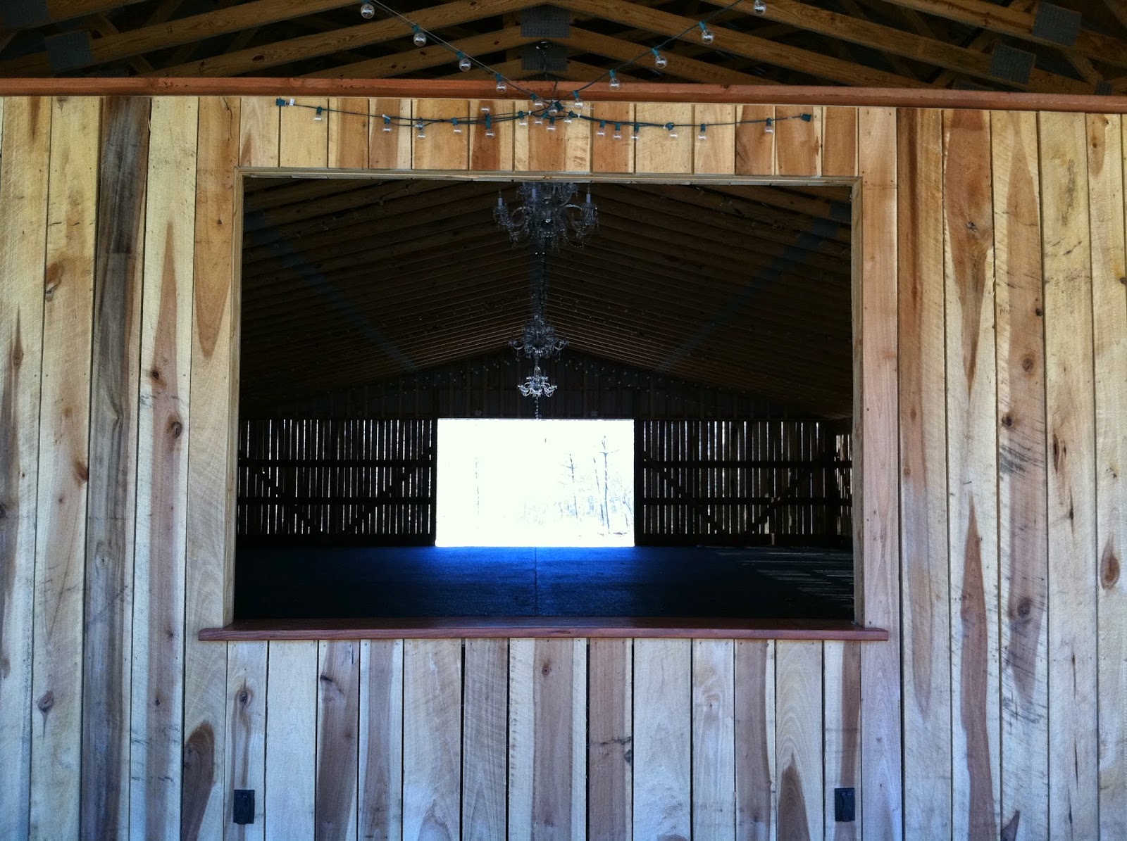
On the selfsame summit, there was an odd structure, recently built.  It looked like a horse stable, but inside there were chandeliers and strings of lights.  What is this place, some kind of mountain dance hall?  Is it a venue for wedding receptions? 
The place doesn't look like it's been used yet, but there's a blackboard on the wall with a list of alcoholic drinks.  And the back porch had a pleasant feel to it.  Even at a modest altitude of 2,600 feet, it was surprisingly colder here than in the city.  And there were far fewer springtime birds up in the hills than down in the suburbs.  
It always scares me a little when I hear an engine in the forest.  Not sure why.  I just prefer to hide from motorized vehicles.  I heard a truck hurrying down the icy mountain road, and I hid inside this dance hall.  I half expected them to turn into the parking lot and catch me, taking me for a middle-aged vandal.  After returning to my car, I did end up finding a better map of the Mountain Streams Trail System at the trailhead.  I'll try to get to the bigger woods the next time I go out--hopefully next week.  I found a better place to park for the segment of trail that I was looking for, and I'm actually kind of dreaming of doing an early spring overnight in the woods.