Friday, June 3, 2011

Moraine State Park

Alas, the water tower that handily rebuffed my advances! It measures exactly sixty feet high, and on my two attempts to climb it, I got no higher than forty-five feet. Have I really grown so fearful in my middle age? I who used to scramble over boulders and up the ragged flanks of the Wichita Mountains so long ago? But these two decades later, a sixty foot long ladder gives me the willies. On a high summit near Lake Arthur--Moraine State Park--I'm sure the top of the tower commands the best view around. But its lofty crown remains inviolable...

The problem with Moraine is that it never really gives you a feeling of remoteness. The unmarked trail up to the water tower is the only exception that I know; at a certain point, you do get beyond earshot of all humanity when you're en route to the tower. Beyond the tower, the trail continues to a silent hay field that the farmer has very effectively blocked with great piles of woodland debris. He doesn't want hikers in his fields. (You can't trust a man who goes to the woods without a gun.)

A "moraine" is a deposit of stones and rocks left by a glacier. I don't know if this park comes by its name honestly, but I do know that much of this land used to be strip mines. One lakeside trail bypasses a private residence right on a distant stretch of beach. It's just a little redbrick farmhouse guarded by a seemingly deaf German Shepherd. In the second photo, you can see the gables rising out of the forest, with the lake in the distance. It would be a placid setting to fritter away your life.

Lake Arthur itself is beautiful, wide and serene. One of the nicer trails ends right here in the water. You've got to love a little-used path that ends at a hidden beach.

I didn't expect to find such lovely silence there at Moraine, since my last visit to the park, five years ago, was so disappointing. I've been avoiding the place ever since. But on the summit near the water tower, not a sound could be heard. No cars, no planes, no motorboats. Only flies, and plenty of them. And the breeze stirring the leaves. And the rich, melodic trilling of the birds. The forest echoed with thier songs. Nothing more. This place is overrun with poison ivy and jaggers.

Tuesday, May 31, 2011

Waterways

Cross Creek is not an altogether unpleasant place to spend a Sunday afternoon in a kayak. It's especially nice if you take the back entrance and paddle about a quarter mile down the little estuary that leads from the parking area to the lake. This little stream is deep and swampy, overgrown with reeds. It's strangely reminiscent of a Louisana swamp.
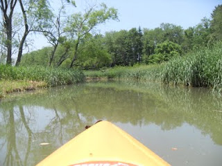
Also reminiscent of Louisana is the number of dead fishes bobbing on the surface of the water. I counted 19 in the first 20 minutes, then I stopped counting because it was ruining my so-called escape. The dead fish (in both Lousiana and Cross Creek) are thanks to the natural gas industry.


The first view is from the deck of the uncovered bridge mentioned below. The second shot is from the deck of Bobbie--the kayak, so named because it bobs on the surface of the water rather than gliding.

The Bridges of Washington County

It used to be a covered bridge. And there's only ever been one reason to cover a bridge: in order to protect the structure from the elements. But Washington County will do whatever it takes to make the gas companies happy, and the Marcellus shale frackers couldn't fit their beastly trucks over the covered bridge, so off came the roof. You can't afford to wax sentimental about "local color" or "regional identity" when Range Resources comes calling.

The result of uncovering the bridge is going to be twofold. First, the structure will rot and collapse because it wasn't built like modern bridges, which don't require roofs. Second, we're one covered bridge the poorer in the Commonwealth. Ah, but these problems aren't yours and mine. We'll allow another generation to sort out the mess.

This is the back way to "put-in" a kayak or canoe at Cross Creek Lake, in Washington County. Going west on PA50, at the village of Woodrow, take a left onto Old Ridge Road and follow it to a sharp leftward turn with a little park road to the right. The park road leads to this once-covered bridge. If you're going paddling, this is so much nicer than the main entrance to the park. It was the Sunday of Memorial Day weekend, but I had the whole place to myself.

On the far side of the uncovered bridge, the road becomes a clay-dirt track the likes of which I haven't seen since my Africa years. It snakes through forest and uphill. Eventually, the little lane remains under deep canopy as the countryside off to the the left opens up dramatically beneath it. The road feels like a mezzanine in darkness, looking out over a vast auditorium, the ancient farmlands and the woodlots of southern Pennsylvania. It gave me the impression of standing in a high, dark balcony that overlooks a large, bright theater or sanctuary.


The tragedy of this place tears at my heart. The weary old countryside first settled in the last decades of the 18th century has seen so much heartache and bloodshed. It's been a place of accute injustice, where the rich in far-off cities have exploited the local poor shamelessly, and at least in recent years, the poor have been complicit in their own dehumanization. This land has been mined, and strip-mined, and farmed, and drilled, and in all of these ventures, poisoned. And yet, her quiet dignity and forlorn beauty are still her own.

The little road is topped with gravel as it reaches the summit, a broad, flat area. As the road draws near to a loud, heinously ugly fracker station, you'll see threatening signs warning that the place is off limits to all except hardhatted employees of Range Resources.

Friday, May 13, 2011

Ryerson Station State Park

More and more, my recreational life seems to drift in the direction of Washington and Greene Counties. I love them. As overrun as they are by frackers, and industrial trucks, and greedy corporations, they still have a bucolic beauty and charm. They're truly Northern Appalachia. I might harbor a few romantic illusions about life in Appalachia, though I shouldn't. I know very well that my kind is not appreciated there. It didn't work in elementary school, and it wouldn't work still today. And yet, it sure is nice to visit.

The main attraction at Ryerson Station State Park was once its lake, which was destroyed when Consol Energy undermined the dam and refused to pay for the damages despite the state's repeated demands. Since the lake is no longer the centerpiece of the park, the PADCNR has put a little more effort into grooming and marking the hiking trails. It shows, too.


The park is divided into four main hikeable segments:


>the west, which has only one linear trail


>the north, which has a few options


>the south, which is traversed by great mazes and labyrinths of trails. I did much of the southern segment today.


The first photo is a 300-year old oak tree known as the "Wolf Tree." But alas, how the mighty are fallen! The second photo is the overlook along the Lazear Trail. There's supposed to be a lake shimmering in the distance, but alas again. I don't know which is more shocking: the fact that an ungodly rich major corporation can destroy public property with absolute impunity or the fact that there's anything left intact. When corporations are permitted to behave in this way, and the sate is either unwilling or incapable of seeking restitution, it's hard to say that we're still a "great nation."

Ah, but we were still just on the road to greatness back in the days when the Second Great Awakening shook the long hollows of Greene County. In the late 1700s, camp meetings and circuit riding preachers made the narrow valleys in the eastern "Ohio Country" sing with their strange music: plain, confident, homespun. Here's a testament to that uniquely American brand of religiosity and individualism that marked the early frontier...and that has been driving us into self-centered oblivion ever since.


Sunday, May 8, 2011

Perspective

The world just looks better from this angle, with the water lapping gently against the side of the kayak, the birdsong in the trees, a light breeze on the lake.

This is Cross Creek Lake, looking more festive than it looked the last time it was featured on this obscure blog. And it was my new kayak's maiden voyage. The lake was busier than I would have liked, and I was just about the only person there without an engine and a fishing pole. I'm thinking we'll look into some alternative destinations next time around. But it's still beautiful to be out on the water. Paddle into a quiet cove, explore the shoreline, pull out a book and a bag of almonds, glare at all the fishers in order to make them think you're a little weird and dangerous, because if they think you're creepy, then they won't steer their noisy-engined lazyman watercraft into your cove and ruin your idyll.

There's nothing like accessing a woodland spot that can only be reached by boat. There are no trails through much of this park, since trails require walking, and the people who use this park don't want to put that much work into it. So the kayak is a great way to reach parts of the forest that can't be reached on foot unless you're willing to bushwack through some thick backcountry.

Actually, the best place I know to boat across the lake to a pristine sylvan haven is at Elk State Park, up north. You begin on the narrow shoreline of the very lame-arse state park, then cross the water to the opposite shore, where you find yorself in the immense and nearly unvisited Elk State Forest. I must make it back up there someday.

Tuesday, May 3, 2011

Contentment

Every grownup knows that there comes a time in your life when you just have to settle for what's offered and make the best of it. It's not exactly that you bury the idealism of your youth, that drive to make a difference in the life of the world, that deep desire to be different from all the others who clog up the system with their unimaginative lives, and their whining, and their selfish exploits. It's not exactly that you give in. But you reach the realization that there's very little else to be and do. And you're not as exceptional as you used to think you were.

That's when the time is upon you to buy a riding mower and spend your free time circling your grassy lawn on it, thinking about crabgrass, and dandelions, and all the myriad other threats to your dreamy idyll. It's not that you ever say to yourself, "Okay, I officially declare that I am part of this world's problems now and no longer in search of solutions." That never happens. But the Bilco door needs painted. The shutters need scraped and repainted, too. The gutter needs cleaned out--again. And the more successful you become, the smaller your world, the more insular.

It's not that you stop caring. It's just that imaginary problems begin to obscure the real ones. And the real threats to a happy life--things like jealousy, and bitterness, and nursing old wounds, and comparing yourself to other people--they go unchecked, while all the supposed threats are hunted down like Osama bin Laden.

As I meditate on the life of the world, I'm beginning to believe that the date is late, time is fearsomely short, and the only work that truly matters now is the most urgent work of restoring the planet for future generations. My particular issue is opposition to Marcellus shale drilling, and I have decided to don my clerical collar and show up at all the protests, to write articles, to publish treatises, to enlist the faith communities to find their voice. There are a thousand ways to throw one's life back into the fray...but that is where Life calls us, to the fray. The way of contentment always entails a cause, a purpose bigger than oneself, a deep sacrifice. In some circles they call it a cross, but it's not limited to any religious tradition. It's a universal truth: new life only comes from death.

Friday, April 29, 2011

More Photos of Enlow Fork

The Enlow Fork Mine is an ugly thing, and though it's several miles from the reserve, you can hear it occasionally as its screeching machines whine eerily over hill and dale. I wish I had a panoramic camera for the second photo, because in the near foreground and to the left was a flock of sheep feeding on a hillside, and a bit to the right was a cemetery in the shadow of "those dark, satanic mills."

Enlow Fork reserve is maintained as a state game land, but it owes its existence to the Western Pennsylvania Conservancy, too. Apparently Consol Energy donated the land in the 80s; they must have been done with it.

The array of colors at Enlow Fork is remarkable, and the blue-eyed Mary (pictured in the previous post) is relatively rare.

Getting to this place is another question altogether. This blog doesn't typically lay out hiking destinations with trail descriptions and locations. (My days as the tour guide of the forest are behind me.) But since I'm sure to forget how to get to Enlow Fork, and since I'll want to return here someday, I list the driving directions below.

From I-70, take exit 11 and get onto 221 south for about 7 miles.

When 221 meets 18 south, follow 18 as it wends among horse farms several miles to route 231.

Turn right (north) onto 231 and head toward W. Findley; after a short distance, 231 bears right, but continue straight onto the unmarked state route 3026, which will lead past the above coal mine.

Where 3026 crosses Ackley Creek Road, go straight through the intersection and cross a rickety, one lane bridge. Follow the road uphill for about a mile and a half, then make a very sharp right onto a gravel road marked with a "state game lands" sign.

This road meanders beneath the coal mine's equivalent to a rollercoaster, or a waterless waterpark ride. It's a long, large, covered conveyor belt with attendant machine monsters. Follow this little lane downhill all the way to a small parking area where the road ends. The trailhead is about 18 miles from where you exited the Interstate.

Welcome to paradise.