Alas, the water tower that handily rebuffed my advances! It measures exactly sixty feet high, and on my two attempts to climb it, I got no higher than forty-five feet. Have I really grown so fearful in my middle age? I who used to scramble over boulders and up the ragged flanks of the Wichita Mountains so long ago? But these two decades later, a sixty foot long ladder gives me the willies. On a high summit near Lake Arthur--Moraine State Park--I'm sure the top of the tower commands the best view around. But its lofty crown remains inviolable...
The problem with Moraine is that it never really gives you a feeling of remoteness. The unmarked trail up to the water tower is the only exception that I know; at a certain point, you do get beyond earshot of all humanity when you're en route to the tower. Beyond the tower, the trail continues to a silent hay field that the farmer has very effectively blocked with great piles of woodland debris. He doesn't want hikers in his fields. (You can't trust a man who goes to the woods without a gun.)

A "moraine" is a deposit of stones and rocks left by a glacier. I don't know if this park comes by its name honestly, but I do know that much of this land used to be strip mines. One lakeside trail bypasses a private residence right on a distant stretch of beach. It's just a little redbrick farmhouse guarded by a seemingly deaf German Shepherd. In the second photo, you can see the gables rising out of the forest, with the lake in the distance. It would be a placid setting to fritter away your life.
Lake Arthur itself is beautiful, wide and serene. One of the nicer trails ends right here in the water. You've got to love a little-used path that ends at a hidden beach.

I didn't expect to find such lovely silence there at Moraine, since my last visit to the park, five years ago, was so disappointing. I've been avoiding the place ever since. But on the summit near the water tower, not a sound could be heard. No cars, no planes, no motorboats. Only flies, and plenty of them. And the breeze stirring the leaves. And the rich, melodic trilling of the birds. The forest echoed with thier songs. Nothing more. This place is overrun with poison ivy and jaggers.

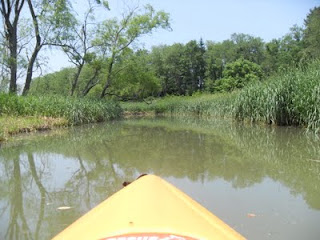
 Cross Creek is not an altogether unpleasant place to spend a Sunday afternoon in a kayak. It's especially nice if you take the back entrance and paddle about a quarter mile down the little estuary that leads from the parking area to the lake. This little stream is deep and swampy, overgrown with reeds. It's strangely reminiscent of a Louisana swamp.