The Enlow Fork Mine is an ugly thing, and though it's several miles from the reserve, you can hear it occasionally as its screeching machines whine eerily over hill and dale. I wish I had a panoramic camera for the second photo, because in the near foreground and to the left was a flock of sheep feeding on a hillside, and a bit to the right was a cemetery in the shadow of "those dark, satanic mills."
Enlow Fork reserve is maintained as a state game land, but it owes its existence to the Western Pennsylvania Conservancy, too. Apparently Consol Energy donated the land in the 80s; they must have been done with it.
The array of colors at Enlow Fork is remarkable, and the blue-eyed Mary (pictured in the previous post) is relatively rare.
Getting to this place is another question altogether. This blog doesn't typically lay out hiking destinations with trail descriptions and locations. (My days as the tour guide of the forest are behind me.) But since I'm sure to forget how to get to Enlow Fork, and since I'll want to return here someday, I list the driving directions below.
From I-70, take exit 11 and get onto 221 south for about 7 miles.
When 221 meets 18 south, follow 18 as it wends among horse farms several miles to route 231.
Turn right (north) onto 231 and head toward W. Findley; after a short distance, 231 bears right, but continue straight onto the unmarked state route 3026, which will lead past the above coal mine.
Where 3026 crosses Ackley Creek Road, go straight through the intersection and cross a rickety, one lane bridge. Follow the road uphill for about a mile and a half, then make a very sharp right onto a gravel road marked with a "state game lands" sign.
This road meanders beneath the coal mine's equivalent to a rollercoaster, or a waterless waterpark ride. It's a long, large, covered conveyor belt with attendant machine monsters. Follow this little lane downhill all the way to a small parking area where the road ends. The trailhead is about 18 miles from where you exited the Interstate.
Welcome to paradise.
Friday, April 29, 2011
Enlow Fork
Enlow Fork is as far-flung and remote as any spot you'll find in the Southwest corner of the state. It's tucked away in the shadow of Consol Energy's Enlow Fork Mine, a sinister looking complex with chutes, and towers, and smokestacks that looms over the hilly, green pasture land in this region of Washington County.
Enlow Fork is actually the name of the creek, and the wild lands here are also known as State Game Lands #302. This place is noted for its abundance of wildflowers, and if you chance across another human here, it's almost certainly a fisher.
This territory is gorgeous and vast. An old country lane--now closed to vehicles--runs through the Enlow Valley and traverses some outdated bridges, as seen in the bottom photo.
I followed a sidetrack up the razorback ridge of a mountain and found myself atop a narrow ridgeline far above the stream. There was no overlook, due to all the trees, but it's nice to sense the height through the trees. I assumed that it would be easy to follow the ridge back down the way I came up, but such was not the case. I ended up in a very different part of the reserve from where I meant to go.
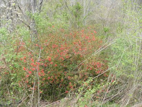
But there were pleasant upland meadows on the mountainside on the way down, as in the second and third photos. Notice the splashes of red and white among the green.
This place can look pristine to the untrained eye, but honestly, nothing is pristine in Southwest PA. This land, too, has been raped. If you look closely, you'll find the scars.
Driving through Washington County is like driving through rural Kentucky. Round, grassy, treeless hills with horses grazing on the flanks. Narrow, winding roads. Enormous farmhouses, many abandoned. Covered bridges. It's really a beautiful place, the coal industry and the newborn Marcellus shale natural gas industry notwithstanding. Just don't drink the water.
Tomlinson Run, West Virginia
Tomlinson Run State Park is in the northern panhandle of West Virginia. It's got some nice wilderness in its western extremes, though I have the impression that the earth beneath it is undermined, since entire hillsides are eroded, many trees are fallen, and in places the trail is washed out. It makes a nice enough day trip from Pittsburgh.
Monday, April 4, 2011
A Room with a View
But it's not much of a view, really. If there's one thing the Coalfield Parson loves more than stumbling across an empty house or cabin in the forest, it's stumbling across a whole gaggle of them. The western stretches of Raccoon Creek SP have several dozen abandoned cabins, a few old-but-maintained cabins, and a handful of newly constructed ones. This remote area can be reached by the 50-some-mile-long backpacking trail that encircles the whole enormous park. Only a few state parks have actual overnight backpacking trails, so it is a pretty nice feature--except that it does occasionally run alongside country roads. Or you can hike into this area, like the Parson did, on a utility easement. The roads that appear on the map have been leased out to a private school, and much of this section of the park--though technically the property of the PADCNR--is off limits to anyone but a sneak. (Good thing there was one of those on hand.) The Linsly School, which wards off interlopers with vaguely threatening signs, claims to be the oldest private school west of the Alleghenies. They keep a very nice "outdoor center" in this part of Raccoon Creek; it reminded the Parson of the grounds of Cherry Run Campmeeting, a crazy-ass Methodist summer colony in Clarion County where his fundamentalist grandmother liked to take him long ago. (Not at all the kind of place for a dour young Calvinist.) The Parson's goal was King's Creek Cemetery, which is also on park property that seems to be leased to private interests. Raccoon Creek is a huge park, but is it so big that the PADCNR can't maintain it without making large portions of it off limits to the general public?